Yr Wyddfa (Snowdon) circular via Rhyd Ddu and Ranger's Paths

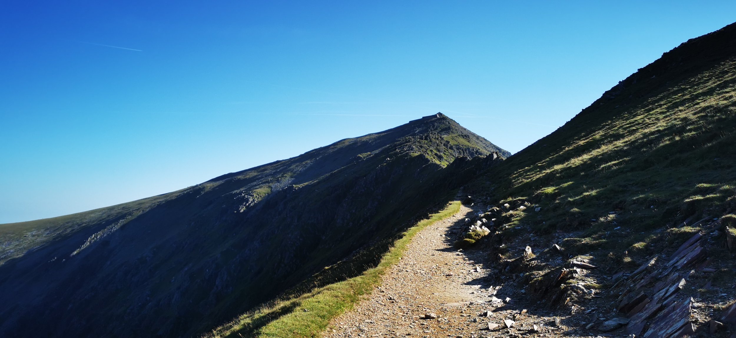
View from just below the summit of Yr Wyddfa / Snowdon, on the Rhyd Ddu route
Quieter than the Llanberis and Pen y Pass routes, combining the Rhyd Ddu and Ranger’s Paths in this way makes for a long day but with the advantage of a circular and the reward of getting to know another side of the mountain. You’ll need a head for heights as although nothing like Crib Goch, the crossing of the South Ridge is airy and narrow.
Need to Know
Best time to walk: Best avoided in strong wind. In winter conditions this is for experienced winter mountaineers only.
Map: OS Explorer, OL 17 Snowdon / Yr Wyddfa
Start: Rhyd Ddu car park / train station / bus stop SH 571 525
End: As start
Distance / Time: 13.5 km / 8.5 miles
Ascent: 955 m
Transport / Parking: Pay & display National Park car park. Steam train stop on the Porthmadog - Caernarfon route. S3 Sherpa bus from Caernarfon.
Food / Drink / Supplies: Great pub Cwellyn Arms in Rhyd Ddu, as is Ty Mawr tea room. Toilets at the start and end. The summit cafe is open in peak season.
The Route
View route map (you will need an OS Maps online account to access it.)

An early start on a hot summer day, the track from Rhyd Ddu
From the toilet building in the car park, head north and go through the gate to cross the rail track. A good path is easy to follow through open land. Be sure to turn off the main track left, heading north east, not east, at a crossroads in tracks shortly after having gone through a gate in a stone wall.

Looking back on the route taken, with Moel Hebog on the left and Beddgelert Forest
The going becomes more rocky and passes around crags and some boggy areas before beginning to climb more steeply up onto the ridge. The path climbs north east.

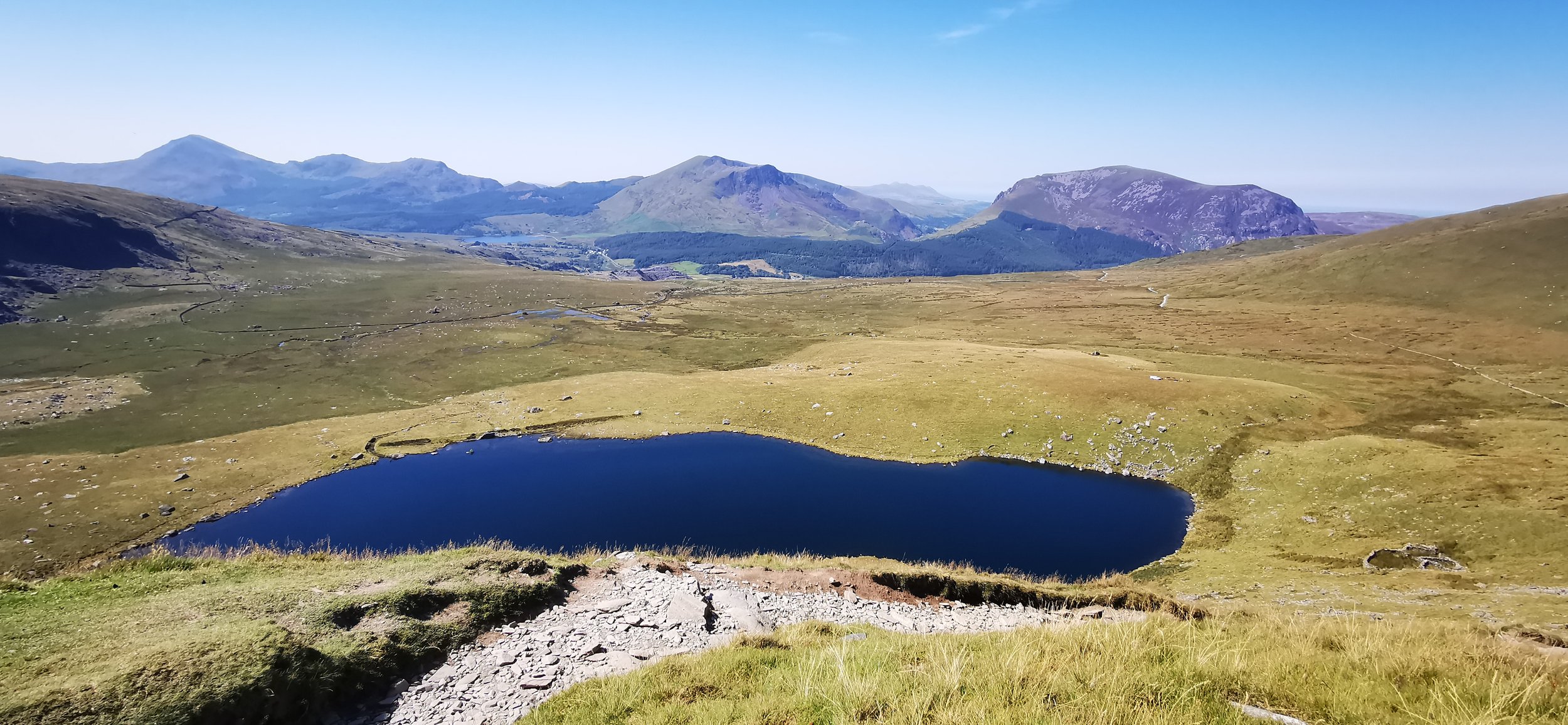
Starting to climb more steeply, looking to Rhyd Ddu, Mynydd Mawr and Llyn y Gader

Rhyd Ddu now far below, with Mynydd Mawr in the centre, Llyn Cwellyn and the Menai Strait visible
Once the ridge is gained, the route turns south-east, through a large stone wall and skirts the edge of Llechog ridge, before zig-zagging north-west up onto the narrow ridge along Bwlch Main. Stick to the left, then skirt right on an obvious path. You’ll pass the stone marker for the Watkin Path on your right. Continue up the rocks, climbing more steep and rocky ground to reach the summit cafe. Walk behind the cafe for the summit and if you’re lucky, fantastic views all around.

Looking across to Clogwyn Du’r Arddu and the descent route
The narrow path along Bwlch Main

The South Ridge of Yr Wyddfa (Snowdon)
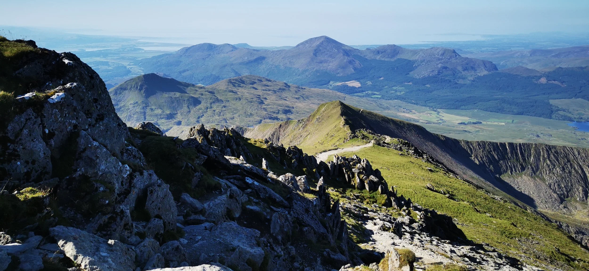
Looking back on the route taken along the South Ridge / Bwlch Main, the Hebog range and Tremadog Bay in the distance
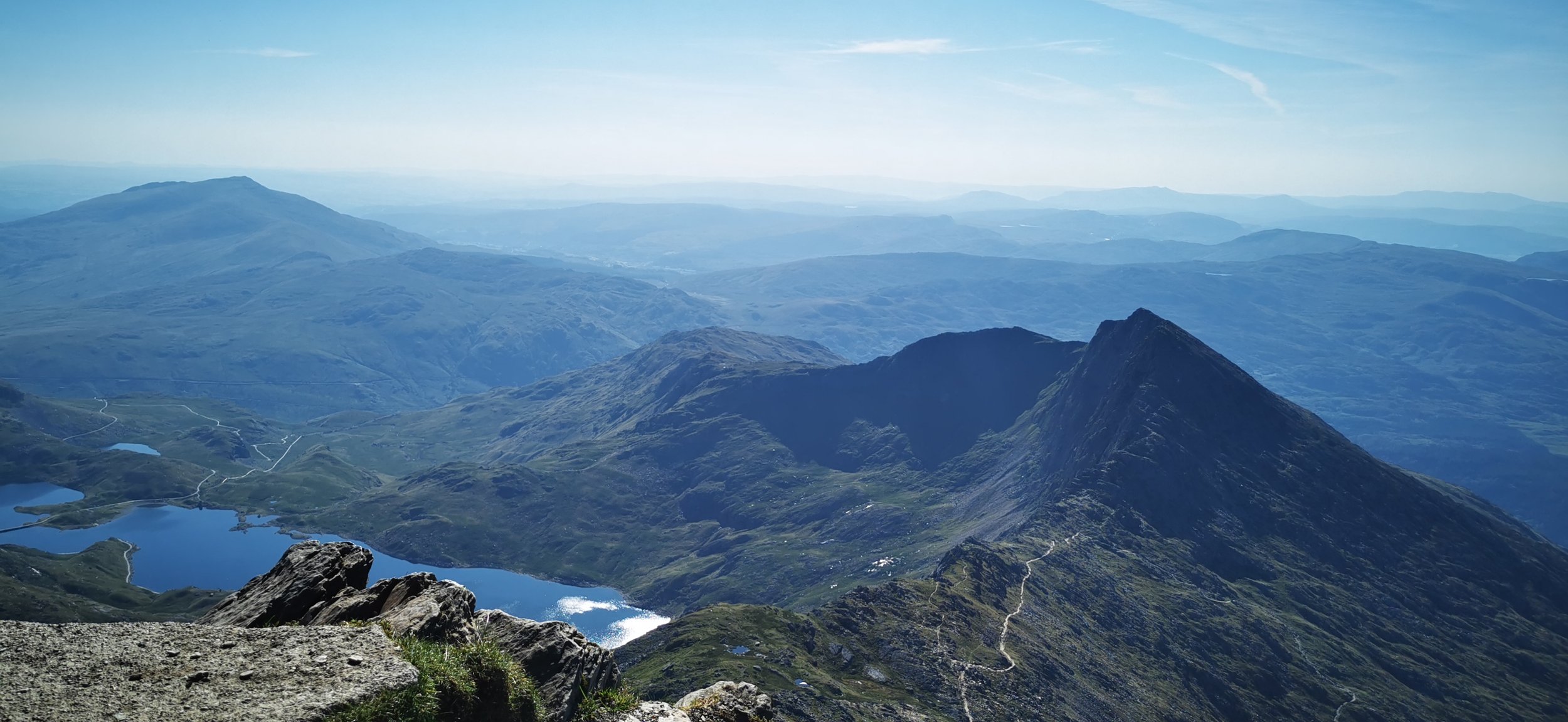
Yr Lliwedd from Copa’r Wyddfa - the summit of Snowdon

Summit views from Yr Wyddfa / Snowdon, with a photobombing seagull

Descent on the Ranger path towards Llyn Cwellyn, Rhyd Ddu just visible a the collection of white buildings on the left
From the summit cairn, follow the steps and path northwards to Bwlch Glas. Here you’ll find the waymarker stone at the top of the Pyg / Miners paths. Take the left most path heading north east, crossing the rail track - look out for trains! The stony path descends steadily, moving away from the train track, then more directly east, above Clogwyn Du’r Arddu. The path zig zags steeply towards Llyn Ffynon y Gwas, then levels out.
Llyn Ffynon y Gwas on the Ranger Path descent, still a way to go

Looking back up to the route taken above Clogwyn Du’r Arddu

The well-made lower Ranger Path

Branching off the Ranger Path to take a public footpath through fields towards the quarries
Keep a look out for and cross a stile into fields on your left just as you reach the edge of the open access land. You’re leaving the Ranger Path here and will continue on an indistinct path through boggy pasture - there are occasional waymarker posts to reassure you you’re on the right track. In very poor visibility head south until you reach a track. In better visibility you’ll be able to head roughly for the centre of the quarry tips up ahead.

Looking towards the quarries and Rhyd Ddu, with the peak of Moel Hebog rising prominently above

The gateway into the quarries
Cross the track, go through the gate and cross the stream on a metal footbridge. Follow the base of the quarry tips then turn uphill in between tips and past a large abandoned quarry building. Climb up on to the slate pile on your right, then descend the other side. Climb a stile over a large stone wall, then walk through boggy ground at the base of crags on your left.

Walking through the quarries and up onto the spoil heap
Cross the railway through the gate, and continue on a good path. There is a fork in the path - one on the right leading to the village if you want to visit the pub or tea room; the left fork takes you back towards the car park. First you’ll come out next to some houses - go through the gate then left behind the houses on the track to return to the car park.

The track back to Rhyd Ddu
Please note this route is for information and inspiration only and we can’t be held responsible for any inaccuracies or problems arising. As this is rough mountain terrain you should take a paper map and compass and be able to use them. Please be Adventure Smart.