Eryri / Snowdonia Day Walk : Rhinog Fach

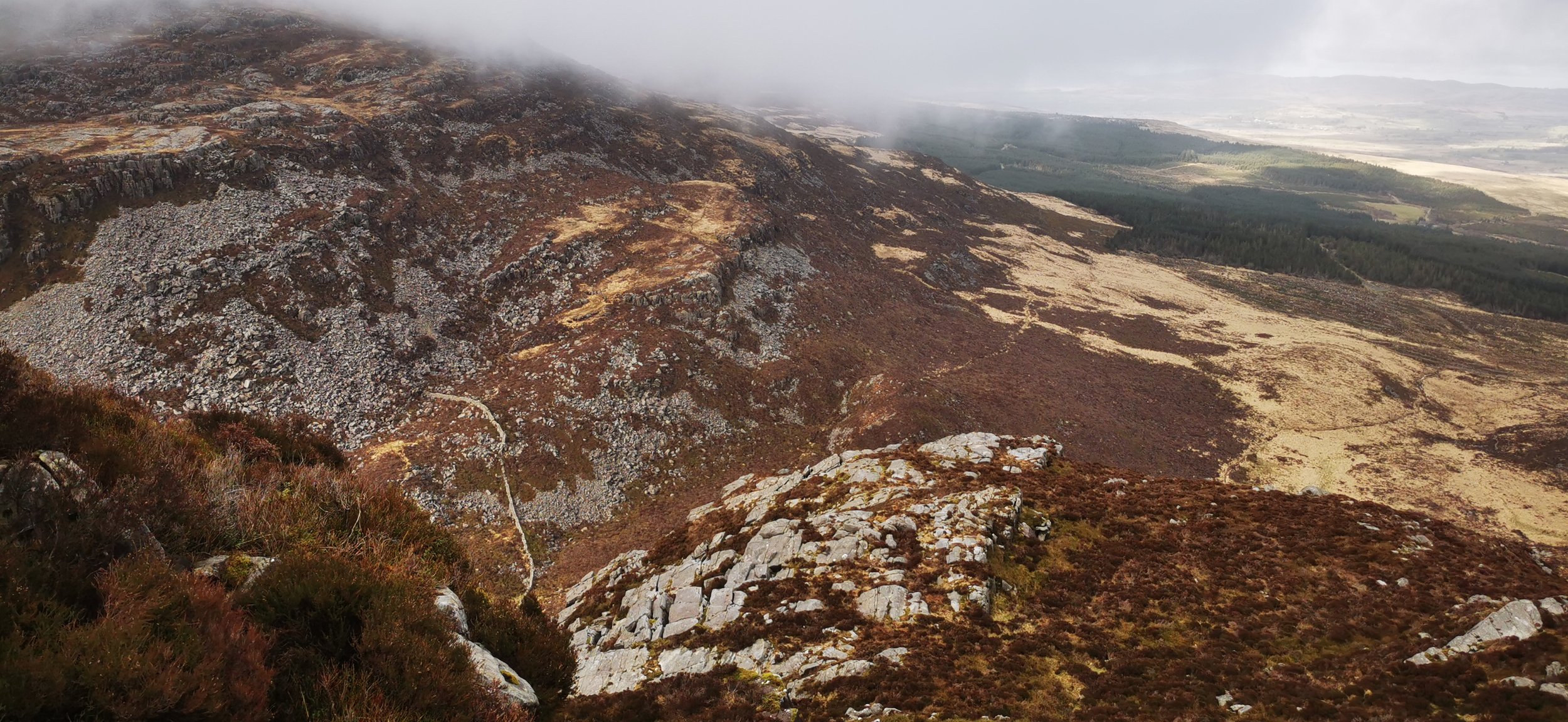
View from the lower slopes of Rhinog Fach
Rough, rugged, quiet and scrambly; the Rhinogydd make a for an unforgettable, if adventurous, day in the mountains! This is the kind of day walk that will leave a lasting imprint on your soul. If you’re steady on your feet and ok with roughing it a bit, you’ll be rewarded to the closest Wales gets to wilderness.
Need to Know
Best time to walk: Dry, mild weather is best for this route, as terrain can become slippery in rain or ice. In winter conditions this is for experienced winter mountaineers only due to technical sections.
Map: OS Explorer, OL 18 Harlech, Bala & Porthmadog for this route
Start: Graigddu Isaf, SH 684 302
End: Graigddu Isaf, SH 684 302
Distance / Time: 11.5 km / 7 miles
Ascent / Descent: 610 m
Transport / Parking: Small forestry car park at Graigddu Isaf (you’ll need to open a gate or two). Buses run along the main road between Dolgellau and Porthmadog; you’ll need to walk a couple of miles in to meet the route.
Food / Drink / Supplies: Plas y Brenin visitor centre cafe is the nearest option for food, drink & toilets. Shops & cafes in Dolgellau (T.H. Roberts does the best coffee and cake).
The Route
View route map (you will need an OS Maps online account to access it.)

Walking along the forestry track from Graigddu Isaf
From the small car parking area, take the right hand track then turn left at the cottage, walking on a track alongside the house and garden. Continue on the forestry track ignoring a left hand turning onto another track and a right hand signposted for a waterfall. Eventually you will leave the trees and the twin peaks of Rhinog Fach, to the left, and Rhinog Fawr, to the right, will be ahead. You’re heading for the gap between the two, turning to follow a narrow track alongside a stream. The track turns into a large stone path, boggy in places. Go through the gate and continue through the gap between the lower slopes of the two mountains.

The path through Bwlch Drws Ardudwy from the East
As you reach the bwlch, or saddle, turn left and follow the narrow path north west, which climbs gradually until a steep rocky section, requiring a short yet tricky section of scrambling. Once over that section, continue north west on a wider slope, keeping the steepest ground to your right, until you reach the summit of Carnedd Llewellyn, our high point for the day.

Beginning to climb the steep heathery path on the north side of Rhinog Fach, looking over to Rhinog Fawr
Looking back to Bwlch Drws Ardudwy and the forest - our route visible on the right here.

Walking along the wide summit ridge of Rhinog Fach, in the cloud
As the gap between the mountains narrows, you’ll meet a wall coming down from Rhinog Fawr on the right. Next to the wall the path heads up steeply southwards - you will probably look at it and think ‘up there - really?’ but that is indeed the route you need to take. It’s a heathery and bouldery scramble straight up the side of the peak. Climb sticking southwards, and eventually you’ll reach a plateau on the East side. Head south eastwards before a sharp turn south westwards, where it becomes steeper again. Once it levels out, turn left / south, to gain the summit plateau, sticking roughly central to find the pile of stones at the summit.

Descending Rhinog Fach towards Llyn Hywel, over bouldery terrain

Llyn Hywel in the mist
From the summit cairn, turn to follow the wall eastwards, then leave the wall to descend southwards. Pick a route down hill over boulders, which is slightly easier if you bear west of the wall before returning to meet it as the ground levels out. At the bottom, look for a path on your right, heading west down to the lake, next to a large slab of rock. Turn right and cross the boulders along the lake side.

Llyn Hywel and the boulders you'll need to negotiate

Looking north to Llyn Cwmhosan

Llyn Cwmhosan
Free of boulders at last, turn north-west to follow a stream downhill towards Llyn Cwmhosan. Walk alongside the lake, descending steeply again to the valley floor of Bwlch Drws Ardudwy. This section can be spectacularly boggy, and you’ll need to cross the wall to follow it eastwards, on the other side, closest to Rhinog Fawr.

Heading back down to Bwlch Drws Ardudwy, with some boggy ground ahead to negotiate

Looking back through Bwlch Drws Ardudwy

Returning on the lower path - as we were running out of light to make the trip to the waterfall worthwhile
Follow the wall eastwards all the way back to the gate. After this you’ll have a choice of returning on the path through the forest that you came out on, or bearing northeast along a higher path which takes you back a different way through the woods, with a track coming in on the left which you can take if you want to visit the waterfall.
Please note this route is for information and inspiration only and we can’t be held responsible for any inaccuracies or problems arising. As this is rough mountain terrain you should take a paper map and compass and be able to use them. Please be Adventure Smart.