Brecon Beacons Mountain Walk: Fan Brycheiniog & Llyn y Fan Fawr

Less visited than its twin lake, Llyn y Fan Fach, Llyn y Fan Fawr and its peak, Fan Brycheiniog, deserve much more attention than they get. Not that this is a bad thing, as other than on the busiest of weekends you’ll only see a handful of people here all day. This is a lovely circular route with a peak to summit, a dramatic escarpment walk, expansive views, and a glittering mountain lake.
Need to Know
Best time to walk: All year round, though the road becomes dicey / sometimes impassable in snow and ice. This route can get quite boggy so reproof your boots if you’re planning to visit during a wet period.
Map: OS Explorer, OL12 for this route
Start: Trecastle Road, just above Maen Mawr
End: Same as beginning
Distance / Time: 8.2km / miles (3 1/2 hours approx)
Ascent / Descent: 400 metres
Transport / Parking: No reasonable public transport to this location sorry! There is roadside parking for a handful of vehicles in a layby beyond the standing stone if coming from the south. The road is narrow and large vehicles may need to get past, please park responsibly.
Food / Drink / Supplies: The International Welsh Rarebit Centre at Defynnog, The Ancient Briton or the Tafarn y Garreg for a quick post walk drink. There is a good cafe and toilets at the National Park Visitor Centre at Craig y Nos.
The Route
View route map (you will need an OS Maps account to access it.)

The beginnings of the Tawe River, looking up to the peak of Fan Brycheiniog
From the parking area, head down to reach the stream - this is the source of the River Tawe which meets the sea in Swansea. Follow the main stream up until you reach ruins of an old sheep fold. Cross the stream here, which is usually fine in all but the very worst weather, and head on a westerly bearing to reach the lake. In good visibility head in the rough direction of the saddle between Fan Brycheiniog and Fan Hir (Bwlch Giedd).

Llyn y Fan Fawr
Once you reach the lake, move anticlockwise until you reach the steep diagonal path behind the lake climbing up to Bwlch Giedd.

The steep path from Llyn y Fan Fawr to Bwlch Giedd

On the climb up to Bwlch Giedd, with Llyn y Fan Fawr below
Once at the top of the Bwlch, turn right to continue climbing up to the summit of Fan Brycheiniog, where you’ll find a shelter and a trig point. The lake is now far below you to the east.

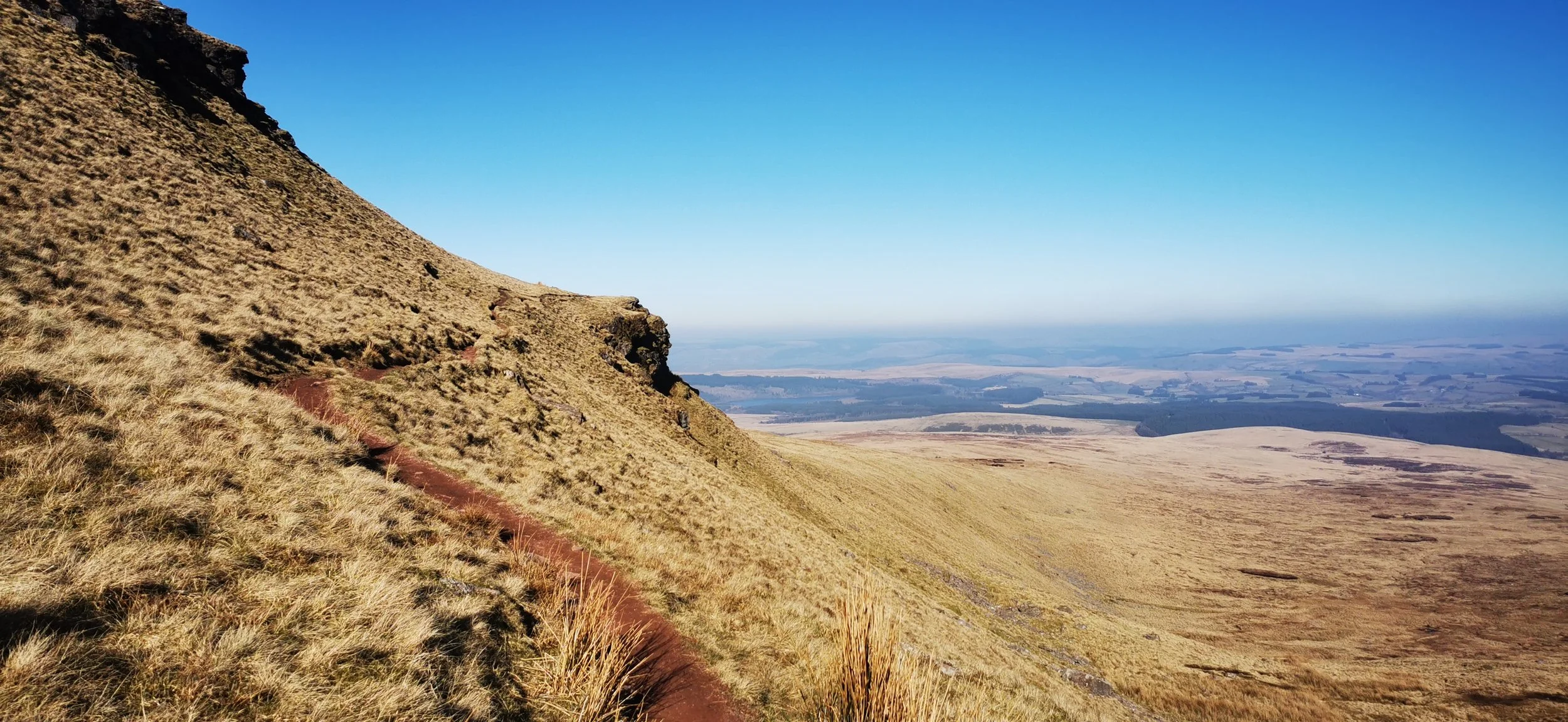
Looking down the steep gully on the path up to Fan Brycheiniog

The path up from Bwlch Giedd, looking towards Fan Hir, with Fan Gyhirch far in the background

Looking down to Llyn y Fan Fawr from Fan Brycheiniog; the summit trig point visible
From the summit, keep the escarpment on your right until you reach Fan Foel, where there is a stone cairn. Carefully make your way down Tro’r Fan Foel, keeping to the ridgeline on a steep path which is eroded in places so you’ll need to descend with care. Poles and shoes with good grip are much recommended.

Looking towards Fan Foel, with the path you’ll be returning on visible far below

Looking back up to Fan Brycheiniog from below Tro’r Fan Foel
Once the path begins to ease, join the path which traverses the base of the escarpments; heading south then south-east back towards the lake. Once at the lake, retrace your steps from earlier in the day to return to the old Trecastle road.
Joining the lower Beacons Way route

Looking back up to the route from earlier

Returning to Llyn y Fan Fawr
Please note this route is for information and inspiration only and we can’t be held responsible for any inaccuracies or problems arising. We advise you to take a paper map and compass and be able to use them. Please be Adventure Smart.