Eryri / Snowdonia Day Walk : Carneddau Circular
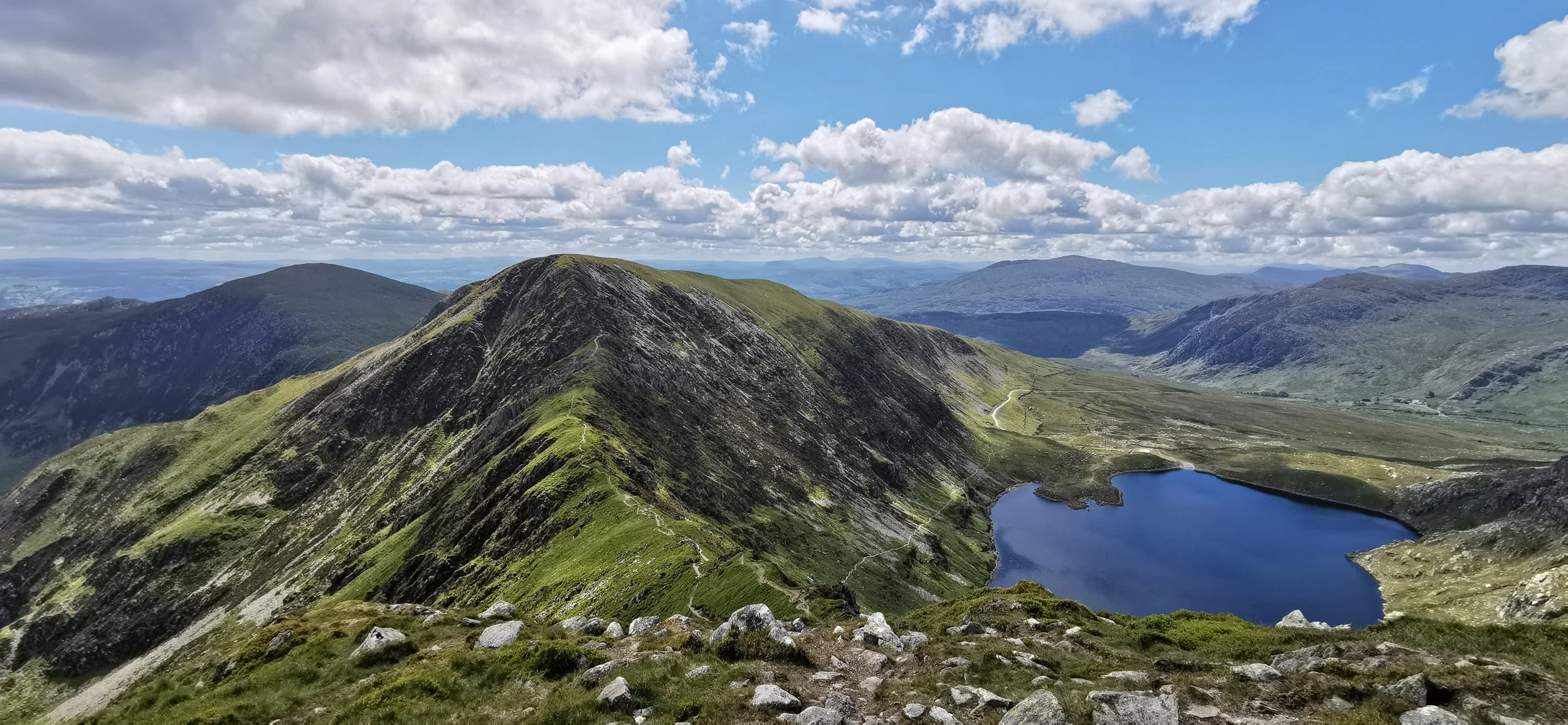
View from slopes of Carnedd Llewellyn over Ffynnon Llugwy reservoir
The Carneddau comprise the largest area of high ground in Wales, and have a grandeur that is unmatched in Eryri. Topped with ancient cairns and named for ancient Welsh princes, with an unique breed of mountain pony roaming wild on the hillsides, this range holds more than a little magic. Some steep rocky ground with short sections of scrambling need to be negotiated on this route, and the broad high tops can be disorientating in cloud, so bring your best navigation skills.
Need to Know
Best time to walk: Dry, mild weather is best for this route, as rocks can become slippery in rain or ice. In winter this is for experienced winter mountaineers only due to technical sections.
Map: OS Explorer, OL 17 for this route
Start: Ogwen Valley, near Gwern Gof Isaf farm
End: Ogwen Valley, near Gwern Gof Isaf farm
Distance / Time: 14km / 8.7 miles
Ascent / Descent: 950m
Transport / Parking: You can pay for day parking at Gwern Gof Isaf or use the long layby nearby. Parking gets full very early in all of the Ogwen Valley so taking the bus from Bethesda is a good idea. Bws Ogwen runs between Bethesda and Capel Curig stopping at Llyn Ogwen.
Food / Drink / Supplies: Kiosk and toilets at Ogwen cottage, pubs and cafe in Capel Curig, shops in Bethesda.
The Route
View route map (you will need an OS Maps online subscription to access it.)

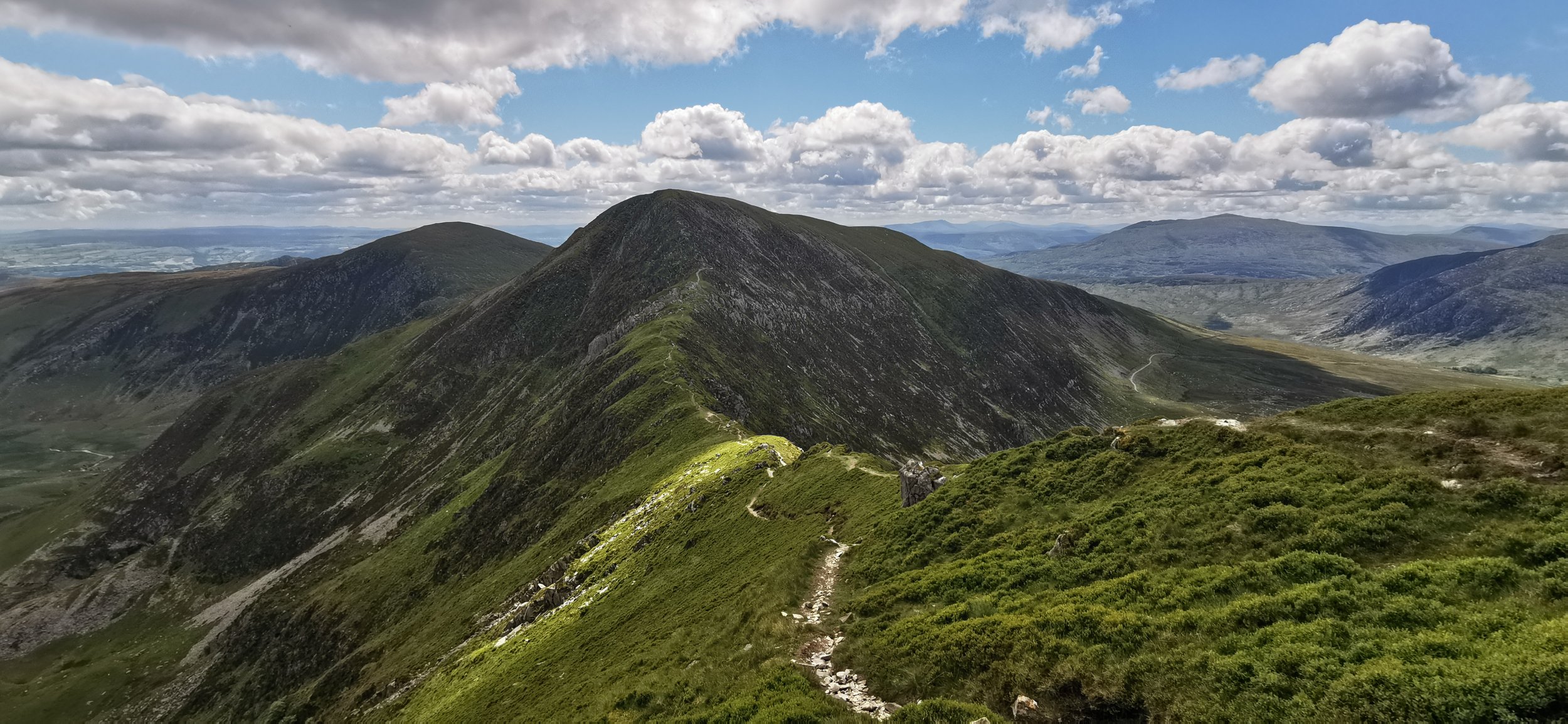
Walking along the Ffynnon Llugwy reservoir
From the Gwern Gof Isaf campsite, cross the A5 and walk along the track heading north east. Follow the track as it climbs then bears north under the crags of Y Braich, to walk alongside the reservoir. Continue with the reservoir to your left, as the path becomes less distinct and more rocky, climbing towards the saddle of Bwlch Eryl Farchog.

As you reach the bwlch, or saddle, turn left and follow the narrow path north west, which climbs gradually until a steep rocky section, requiring a short yet tricky section of scrambling. Once over that section, continue north west on a wider slope, keeping the steepest ground to your right, until you reach the summit of Carnedd Llewellyn, our high point for the day.
Looking back over Bwlch Eryl Farchog towards the peak of Pen yr Helgi Ddu.

Near the summit of Carnedd Llewellyn
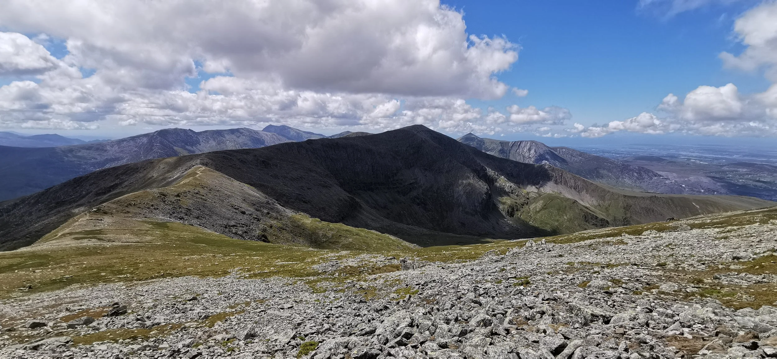
Looking towards Carnedd Dafydd from Carnedd Llewellyn
From the summit of Carnedd Llewellyn, marked with a large cairn, head south down the rocky and grassy slope to a narrowing ridge, bearing south west then west, with dramatic cliffs to your right, climbing gradually again to reach the summit of Carnedd Dafydd.

Looking back to Carnedd Llewellyn, and the cliffs of Ysgolion Duon

Looking towards Pen yr Ole Wen from Carnedd Dafydd, with Yr Wyddfa in the distance
From the summit of Carnedd Dafydd, also marked by a large cairn, turn south west, skirting the valley Cwm Lloer, in good weather the lake will be visible far below to your left. A short southwards climb brings you to the summit of Pen yr Ole Wen. From here, keep the lake and cliffs to your left and begin to descend. There is another tricky yet very short section of scrambling here which needs to be negotiated on the descent - there are no good options for avoiding it.
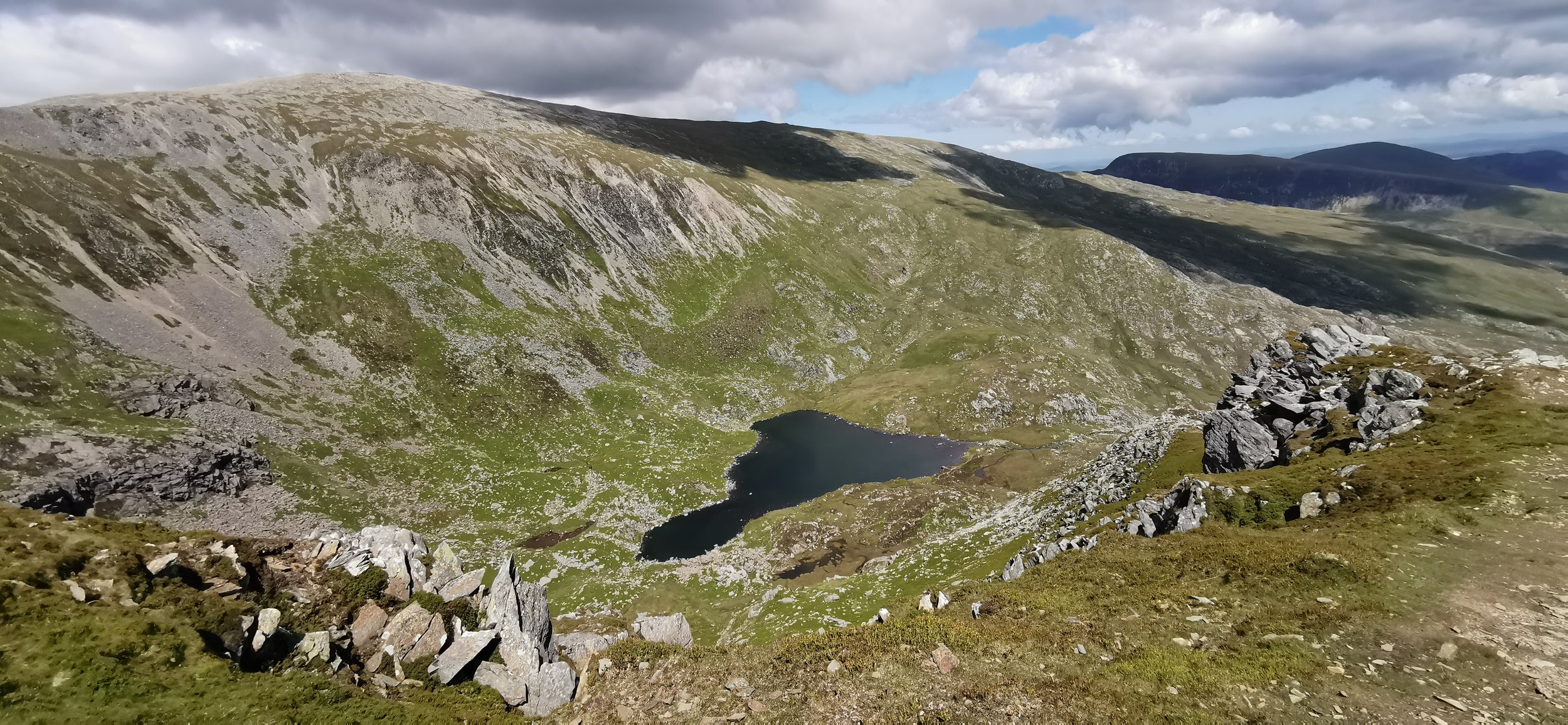
Cwm Lloer with Ffynnon Lloer lake at the bottom, as seen on the descent of Pen yr Ole Wen

Looking over the valley to Tryfan and Llyn Ogwen.
Continue descending eastwards, until you reach the Afon Lloer which flows out of the lake. Turn and follow the path southwards, with a spectacular view of the Glyderau range ahead of you over the valley. Keep the stream on your left, there is a path but it becomes indistinct in places. Cross a stile and continue following the stream downhill, to just above the farm buildings, where you’ll cross the stream and walk on the left hand side of the buildings, then down a track back to the main road.
Cross the road and turn left onto a track, following it all the way back to Gwern Gof Isaf.
Please note this route is for information and inspiration only and we can’t be held responsible for any inaccuracies or problems arising. As this is rough mountain terrain you should take a paper map and compass and be able to use them. Please be Adventure Smart.