Cambrian Mountains Walk: Pumlumon Southern Circular

The highest summit in mid-Wales, Pumlumon also gives rise to three great rivers; the Wye, the Severn and the Rheidol. It’s position in the centre of Wales allows for sweeping views where you imagine you can see the entire country; from the Brecon Beacons rising dramatically in the south, to the coastline of Pembrokeshire and Pen Llyn, as well as the mountains of Eryri.
Need to Know
Best time to walk: This is a great route for all year round, though can get boggy in places after lots of rain.
Map: OS Explorer, 213 for this route
Start: Eisteddfa Gurig Farm
End: Same as beginning
Distance / Time: 10km / 6 miles - allow 3 - 4 hours
Ascent / Descent: 430 metres
Transport / Parking: The X47 runs between Aberystwyth and Llangurig past the start point (ask to request a stop). Trains at Aberystwyth. Limited parking at Eisteddfa Gurig Farm (£5 cash).
Food / Drink / Supplies: The Black Lion in Llangurig, or Tafarn y Maes in Capel Bangor on the road to Aberystwyth. Fuel & snacks in Ponterwyd.
The Route
View route map (you will need an OS Maps online subscription to access it.)

From the car park, walk through the farm buildings, taking a right between barns to reach a track which runs alongside the stream. Take the higher track on the left, and follow this up past a large barn. Take a left near the barn when the track you’re on bends away to the right. Follow this track all the way up to a fenceline near an area of conifer trees. Here the route turns right, joining the Cambrian Way to follow the fenceline with it on your left.
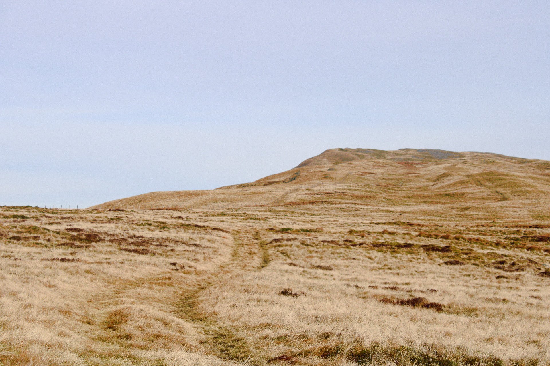
Looking towards the summit of Pumlumon Fawr
After the trees, the track veers right and becomes much more indistinct. In poor weather keep to the fenceline, heading northeastward, climbing gradually. The ground to your left will begin to drop away steeply, more so as you approach the summit.

Stone shelter cairn at the summit of Pumlumon Fawr overlooking the Nant-y-Moch reservoir.
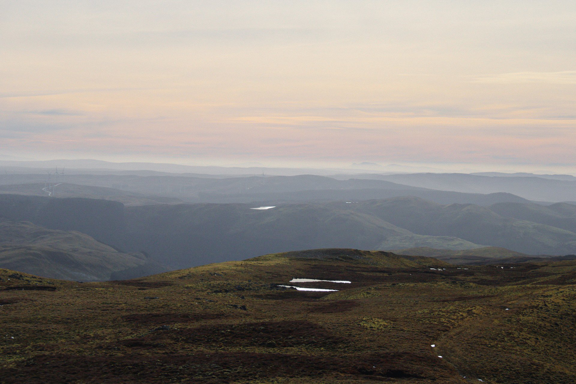
Looking south, the peaks of the Brecon Beacons are just visible in the haze.
Cross a stile to reach the summit. Follow the fence on your right down to a boggy dip, before climbing gently back uphill with steep ground on the left. When you reach the top of this point, below you to the south east will be the drainage basin where the source of the river Wye can be found. Return to the summit of Pumlumon, taking a path straight ahead of you as you cross the stile.


Looking over the source of the river Wye
The path takes you south - south east down to an old disused mine, where you can follow the Afon Tarennig southwards back to the farm.
Please note this route is for information and inspiration only and we can’t be held responsible for any inaccuracies or problems arising. We advise you to take a paper map and compass and be able to use them. Please be Adventure Smart.