
South Wales Coast Half Day Walk: Merthyr Mawr

The ruins of Candleston Castle
With woodland, sand dunes, beach, river estuary and a crumbling castle ruin all in a relatively small area, this is a hugely varied circular walk great for spotting wildlife. With no stiles and a beach open to dogs all year round, this is a great dog-friendly route.
Need to Know
Best time to walk: Autumn and winter for migratory birds on the estuary, or spring and summer for a huge variety of wild flowers.
Map: OS Explorer 151. There are few contour lines marked on the map in this area due to shifting sand dunes, but a compass is good to have to hand here.
Start: Merthyr Mawr Car Park (pay and display)
End: Merthyr Mawr Car Park (pay and display)
Distance / Time: 6.5km / 4 miles
Ascent / Descent: 100m
Transport / Parking: Train station in Bridgend is on the Swansea - London Paddington line. No local buses serve Merthyr Mawr so you’d either have to walk down from the station (approx 5km via Newbridge Fields and New Inn Bridge), or take a taxi and pre-arrange a pick up. There is a fairly large car park where the walk starts, which is pay and display - coins only.
Food / Drink / Supplies: There are no facilities on the walk but sometimes there is a catering van in the car park at the start & finish of this walk, or try Ewenny Garden Centre, Cobbles, the Fox or Farmer’s Arms in St Brides Major or the Three Golden Cups in Southerndown. Basic toilets are in the car park.
The Route
From the car park, head back towards the lane you drove in on and look for a narrow path going in to the trees on your left. Hidden from sight of the car park during summer, many visitors often miss the amazing castle ruins which are just a hundred metres away! These are the ruins of Candleston Castle, better described as a fortified mansion house, dating back to the medieval period. You can still see the fireplaces and where windows have been blocked up, presumably to save on taxes. Once you’ve finished exploring the castle, take the path back out into the car park and turn right, following a narrow track which runs underneath the old castle walls - if you look carefully into the trees you’ll be able to see them. You’ll see a stream and wooden bridge on your left, keep heading straight along the track.

Through the coppice woods
Shortly you’ll see a bridleway on your left, and a steep sandy track takes you uphill through the woods. Keep following this uphill and when it branches off to the right near a fence, take the path straight on, with the path becoming narrower and surrounded by vegetation above head height. You’ll arrive next to a small parking area, at the edge of the common land with private land. Keep the fence on your right and follow it closely. At one point it will try to direct you through a gate into a cow field. Instead, stick in the trees to the left of the gate and follow the fence on your right once again. This path will take you downhill through a gate and into some beautiful coppice woodland. Keep to the main path here, you’ll see paths coming in from both sides.

Out onto Newton Beach
After approximately one kilometre you’ll come out of the woods into an open area, where you’ll be able to see some houses up on the hill above Newton. There are many paths heading into the sand dunes here, some of which try to lure you into bogs, but whichever one you take be sure to head south, into the sand dunes, and out at the beach. You have two options; follow the Wales Coast Path which tucks just into the sand dunes and runs parallel to the beach; or walk along the beach itself.

Walking along Newton Beach with Ogmore village up ahead over the river

Following the Ogmore River upstream
Follow the beach east, all the way to the river with Ogmore on the other side. When you’re nearing the river you have the option to head into the sand dunes to climb the highest one around for fantastic views, before rejoining the path at the river. Or, just stick next to the river and follow the Wales Coast Path route around above the high tide mark.

Following the Wales Coast Path back through the dunes to the car park
You’ll reach a small wooden bridge over a stream, and here you should follow the path inland. This is still the Wales Coast path, and it follows the stream along sandy trails where you’ll often spot wild flowers, butterflies, moths, bees, birds and rabbits running around.
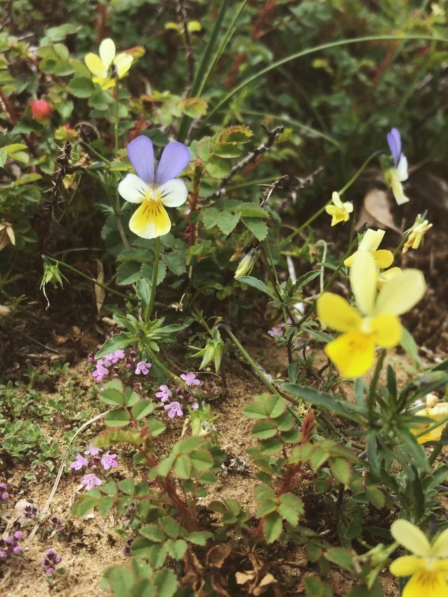
Wild Pansy & Wild Thyme love the sand dune habitat
Eventually the path will lead you back into woodland, and you should follow a fence line northwestwards onto a track which brings you back out in the car park.

Sandy trails through the dunes
Please note this route is for information and inspiration only and we can’t be held responsible for any inaccuracies or problems arising. We advise you to take a paper map and compass and be able to use them. Please be Adventure Smart.