Brecon Beacons Day Walk : Fforest Fawr Five Peaks
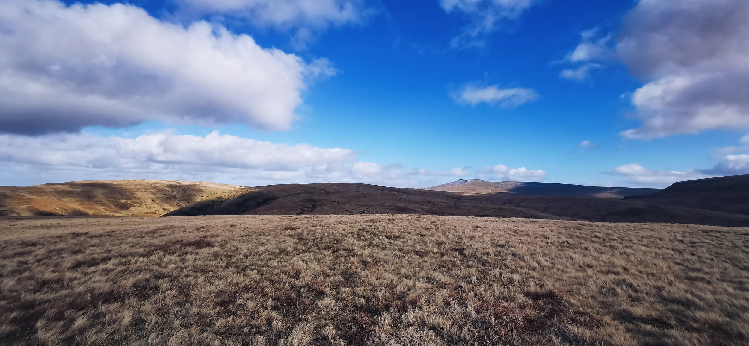
Room to breathe. With views to Pen y Fan and Corn Du in the far distance
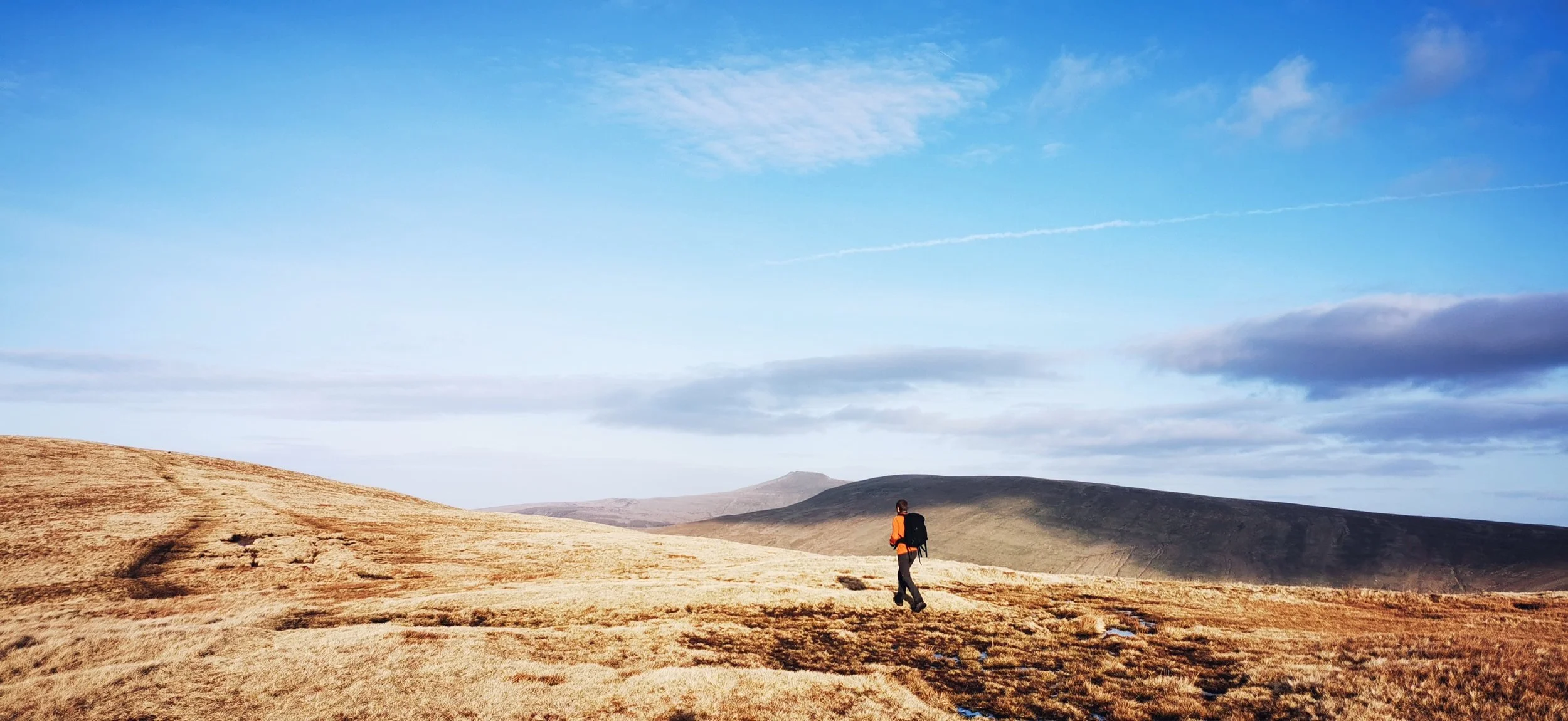
A long day walk taking in five 600m summits, in the vast open landscapes of the Fforest Fawr region of the Brecon Beacons National Park; Craig Cerrig Gleisiad, Fan Nedd, Fan Llia, Fan Dringarth and Fan Fawr. This is a remote walk with a fair amount of ascent and rough ground without paths. You’ll need good navigation skills, particularly in low visibility. This walk starts just a stone’s throw from the popular Pen y Fan and Corn Du routes, but the reward from stepping off the busy trails is a feeling of vast space, open skies, far reaching views, and barely a soul to be seen.
Need to Know
Best time to walk: Late spring or summer for longer daylight and marginally less boggy ground. Keep dogs on a lead during spring and summer as ground nesting birds are easily disturbed in this area.
Map: OS Explorer, OL 12 for this route
Start: A470, near Storey Arms
End: A470, near Storey Arms
Distance / Time: 22km / 14 miles, allow 6-8 hours
Ascent / Descent: 1000m
Transport / Parking: X4, T4 and T14 bus services connect this route to Cardiff, Brecon & Abergavenny. Lay-by’s along A470 near Storey Arms offer parking, can get very busy at times.
Food / Drink / Supplies: A few snack vans in the lay-by’s along the A470, otherwise head to Merthyr or Brecon for shops.
The Route
Link to route card (you’ll need an OS Maps Online account to access it)

Climbing up on to Craig y Fro leaving the busy A470 road behind.
From the bus stop / layby opposite Storey Arms cross the stile to follow the Beacons Way. Or if starting from the the next lay by along, cross the stile southwards and climb 50 metres to join the Beacons Way. The route is a well worn narrow path along the edge of the ridge, parallel to the A470, passing a series of streams and cascades along the way, until you reach a fence line alongside Craig Cerrig Gleisiad, at which point you turn and follow the fence uphill to where it levels out and there is a large pile of stones.

Views towards Pen y Fan and Corn Du from Craig y Fro
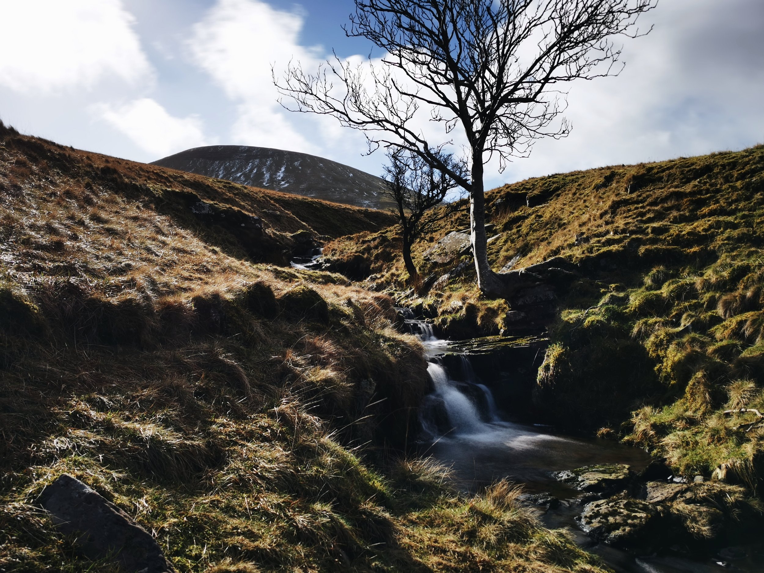
One of the cascades on the trail with Fan Fawr in the distance

The fenceline running alongside Craig Cerrig Gleisiad

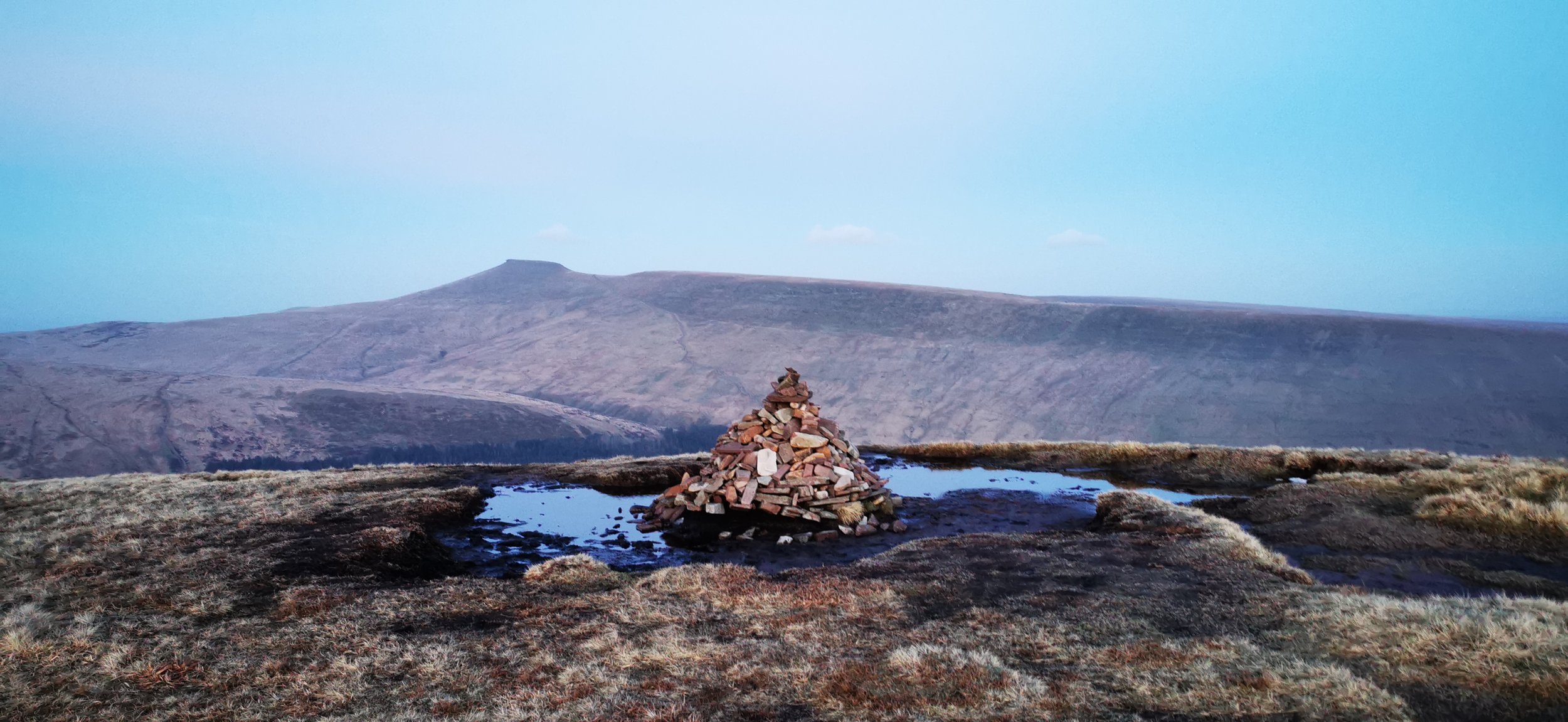
Pile of stones at the summit of Craig Cerrig Gleisiad
From the 629m pile of stones at Craig Cerrig Gleisiad, turn away from the fenceline and head south west for Craig Cwm Du. There are a couple of piles of stones along this section of boggy route where the path can be faint - in poor weather it would be best to take a bearing here to get you to the fenceline at Craig Cwm Du. From here follow a very broad, grassy ridge southwards towards Fan Dringath, dropping off west after the Nant Ystwyth drainage basin, towards the Roman road at 460m. Cross the Roman Road, and head for a stone wall and very small b-road.

Walking towards Craig Cwm Du with Fan Nedd, Fan Gyhirch and Fan Brycheiniog in the distance.

Views over Heol Senni from Craig Cwm Du

Walking towards Fan Dringath, with Fan Nedd across the valley

Sarn Helen, the Roman road which crosses through the Llia valley.

Old stone wall near Maen Llia standing stone
If you wanted to take a small diversion here to visit Maen Llia Neolithic standing stone, when you reach the road just follow it south for a short way, before returning back to the stone wall and viewpoint just before the road heads steeply downhill into Heol Senni. To continue on the route, follow the wall uphill, crossing a stile, then eventually branching away from the wall and climbing steeply for a short while to reach a large cairn with incredible panoramic views. From the cairn, head south to the trig point at the true summit of Fan Nedd.

Following the stone wall up to Fan Nedd

Branching away from the stone wall, for a steeper climb, Pen y Fan, Corn Du and Craig Cerrig Gleisiad in the distance and stunning views over Heol Senni

At the cairn, with views of Fan Gyhirch and Fan Brycheiniog in the distance

Heading from the cairn to the summit of Fan Nedd

Trig point at Fan Nedd
From the trig point head directly south, then south east over very rough, boggy and trackless terrain to reach a stile next to Nant y Groes. Again in poor visibility a bearing would be very useful here as there are few features other than the small stream and some small boundary stones to locate. Cross the stile and walk along the b-road heading south for a very short distance until you reach a stile on your left. Cross this and head down to the Afon Llia and a bridge crossing it. Cross the bridge then immediately turn left, then right after 100m or so. At this point, it is easiest to keep the fence on your left, and walk steeply uphill to meet the crest, where there is a stile to cross the fence at about the 450m contour line. Cross the stile and head north to the summit of Fan Llia. Then, continue north east to Fan Dringarth, which barely feels like a summit in it’s own right, and the craggy depression along its eastern slopes.

Heading down from Fan Nedd towards the Afon Llia, centre left

Following the old stone wall up from the Afon Llia

Crossing the stile to head up to Fan Llia
Heading up to Fan Dringarth from Fan Llia

Views over Heol Senni from Fan Dringarth

View of the Ystradfellte reservoir from Fan Dringarth
From Fan Dringarth, continue north towards Craig Cwm Du. About half a kilometre before the fence line at Craig Cwm Du, head of east downhill towards the Nant y Gaseg where you’ll join a path heading across to Nant y Gwair and Nant Mawr before climbing steeply up to the summit of Fan Fawr. Unless you particularly want to visit the trig point just head straight for a pile of stones marking the 734m summit, and the highest point of the day’s walk. If you time it right this is a great place to enjoy a sunset. From the pile of stones head north, then descend north east on a very steep eroded path at first, easing onto some very boggy terrain, then more steeply again towards Storey Arms.

Crossing Nant y Gwair

Views back to Ystradfellte reservoir

Nant Mawr

Looking up to the final ascent of the day, Fan Fawr

Heading for the pile of stones at the summit of Fan Fawr
The summit of Fan Fawr, looking over to Corn Du
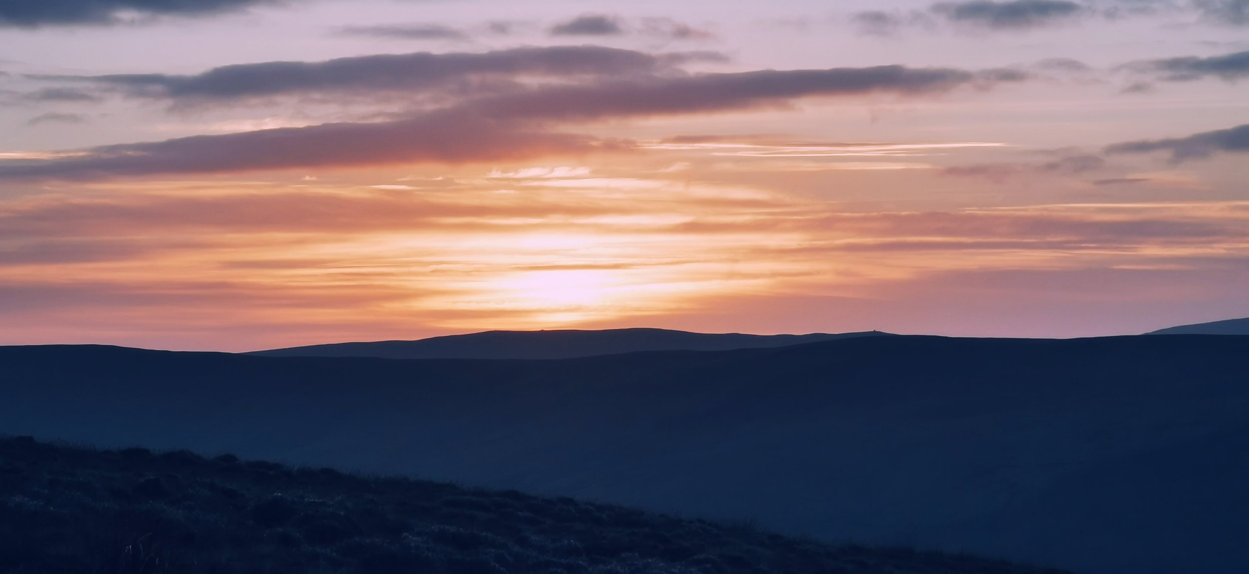
Sun setting over Fan Nedd, if you look closely you can see the cairn and trig point visited earlier in the day

Heading off Fan Fawr back to the A470.
Please note this route is for information and inspiration only and we can’t be held responsible for any inaccuracies or problems arising. As this is rough mountain terrain you should take a paper map and compass and be able to use them. Please be Adventure Smart.