
Pembrokeshire Day Walk : Marloes Peninsula

Looking over to Skomer Island from Wooltack Point
This part of the welsh coastline is often overlooked as day visitors pass through on their way to Skomer Island. This mainland circular walk offers panoramic ocean views and great wildlife spotting opportunities in its own right.
Need to Know
Best time to walk: All year round - but Autumn to spot seal pups.
Map: OS Explorer, OL 36
Start: Marloes Mere National Trust Car Park
End: Marloes Mere National Trust Car Park
Distance / Time: 9.5km / 6 miles
Ascent / Descent: 465m
Transport / Parking: The 400 Puffin Shuttle runs from St David’s to Marloes every day during summer, and less frequently at other times of year. The 315 runs from Haverfordwest and Milford Haven to Marloes - connecting with trains from as far as London.
Food / Drink / Supplies: The fantastic Runwayskiln a couple of hundred metres from the National Trust car park is perfect for cakes, coffees, and freshly cooked hot meals. There is a small village shop and pub in Marloes. If you’re lucky you’ll find the Wildlife Trust shop open at Martin’s Haven half way round the walk for refreshments.
The Route

The lane toward’s Martin’s Haven
Begin your walk at the National Trust Car Park near Marloes Mere. Walk through the car park northwards and along a narrow lane before meeting the main lane. Turn left to head west, keeping an eye out for traffic here. Follow the road for just less than a kilometre. You’ll pass a farm on your left, then after another half a kilometre look out for a public footpath signpost on your right.
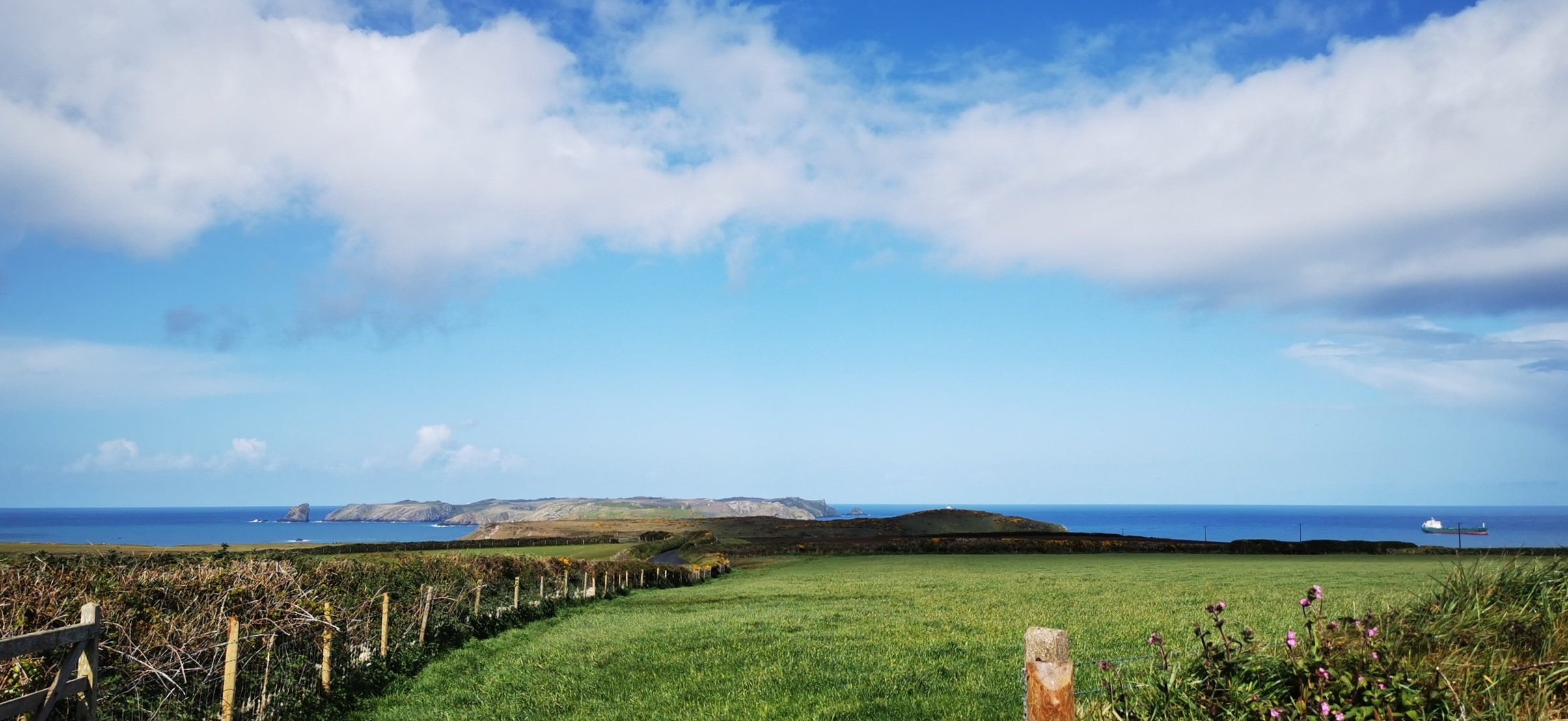
Following the footpath sign into the fields on your right, head straight ahead; the views will open up on your left over towards Skomer Island. Keep to the left hand hedgeline through three fields and you’ll eventually meet the coast path.

The Pembrokeshire Coast Path towards Martin’s Haven
Turn left when you reach the coast path and follow it all the way to Martin’s Haven. The views here are wonderful over St Brides Bay and towards the St David’s Peninsula.

A seal basking in Martin’s Haven
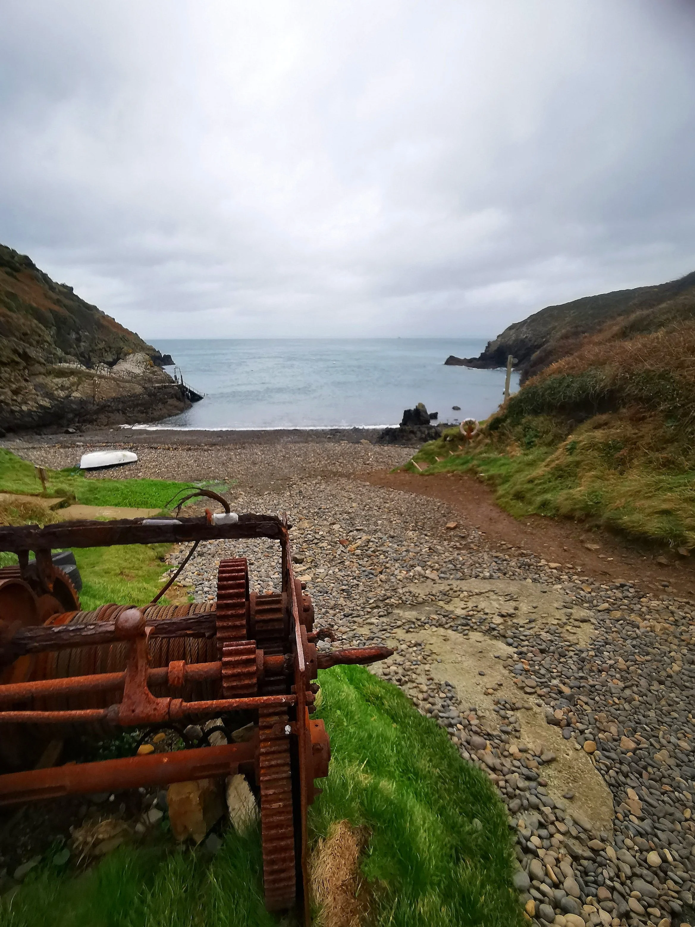
Martin’s Haven deserted in winter

Wooltack Point
From Martin’s Haven, walk uphill along the lane, past a toilet building on your right. Look out for a footpath leading off right before you get to the top of the lane. Follow a steep track uphill towards the lookout tower, then out towards the far point of the peninsula, Wooltack point.

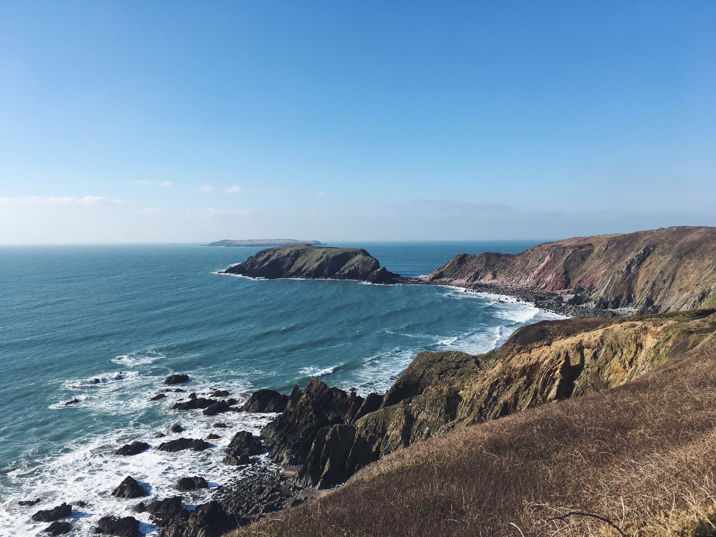
The view over Jack Sound to Midland Isle and Skomer from Wooltack Point, on a wild winter day
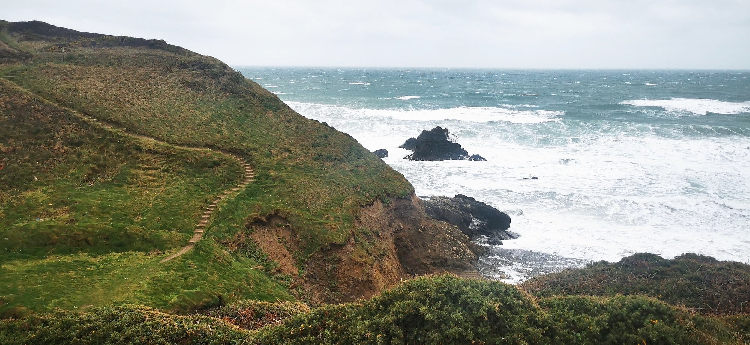
From Wooltack Point turn and hug the cliff edge (though not too close!) keeping the sea to your right. Keep a look out for seals and porpoise in the sound below, with views over to Skokholm Island.

Leaving the Deer Park behind as you pass the stone wall, rejoin the Pembrokeshire Coast Path and continue for a couple of kilometres with the sea always to your right, past Gateholm Island and then descending steeply to Marloes Sands.
The path to Marloes Sands
You have two options here; you can either take a path inland at the top of the hill, which will bring you out at the Runwayskiln cafe. Or if you want to visit the beach, descend steeply then take the middle path going inland once you’ve been to the beach, rather than up the steep steps on the other side. This path turns into a lane which will bring you out back at the National Trust Car Park.

The Runwayskiln Cafe
Please note this route is for information and inspiration only and we can’t be held responsible for any inaccuracies or problems arising. We advise you to take a paper map and compass and be able to use them. Please be Adventure Smart.