Brecon Beacons Day Walk: Waun Fach & Y Grib (Dragon's Back) circular

Home to artists, writers and creatives, the Black Mountains may not offer the same dramatic glacial escarpments that can be seen in the central and western Beacons, but the views are sweeping and this walk reaches the third-highest peak in the Brecon Beacons National Park, Waun Fach, and descends via the airy ridge of Y Grib, otherwise known as the Dragon’s Back.
Need to Know
Best time to walk: Spring to listen to Skylarks & Golden Plover that nest on the heath.
Map: OS Explorer, OL 13 for this route
Start: Pengenffordd pay & display at the pub
End: Pengenffordd pay & display at the pub
Distance / Time: 11.5km / 7.2 miles
Ascent / Descent: 580m
Transport / Parking: Nearest train station is Abergavenny. Buses to Talgarth.
Food / Drink / Supplies: Dragon’s Back pub at Pengenffordd is at the beginning & end of this route. Supplies in Talgarth.
The Route
View route map (you will need an OS Maps online subscription to access it.)

Sunken lane heading up towards Rhiw Trumau
From the Dragon’s Back pub, take the track leading behind, following it in a south-easterly direction until it reaches a lane. Turn left, follow the lane past the riding stables and uphill. When it forks off left, keep ahead, then take a left hand turning up an old sunken green lane, which climbs steadily uphill between fields.

Looking back down the track across Rhiw Trumau
Go through the gate at the top of the lane, and begin climbing more steeply up the slope of Rhiw Trumau. At the top the track widens and becomes less distinct. The easiest option navigationally is to head east to the bwlch (saddle) at 618m, where there is a cairn. It can be very windy here!

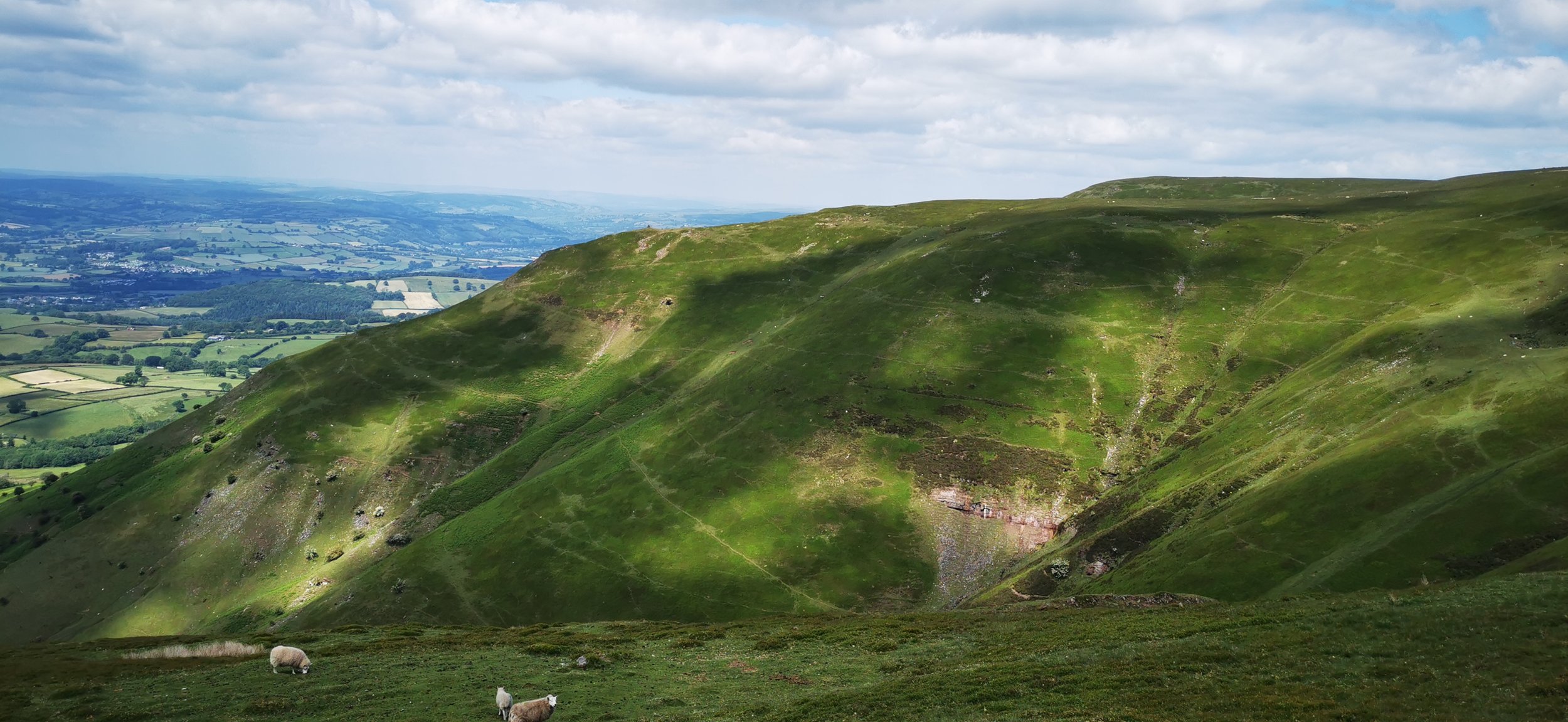
Views from Rhiw Trumau

At Pen Trumau
Once at the bwlch and Cairn, head north, climbing up a rocky slope to reach Pen Trumau, where the slope becomes gentler. With steep ground on your right, head for the centre of the broad ridge, following a fairly good path, to reach the summit of Waun Fach, the high point at 810m. It’s a fairly unceremonious peak, but the views from here on a clear day are fantastic. Keep an eye out for mountain ponies and ground nesting birds such as Skylark, Golden Plover & Grouse.

Brecon Beacons mountain ponies
From Pen y Manllwyn, looking towards Mynydd Bychan
From Waun Fach head north west, with steep ground now to the left of you. There is a good path here and you will descend slightly before it flattens off for just over a kilometre. As it begins to descend again, at Pen y Manllwyn, you will descend south-westerly, across a broad grassy and sometimes very boggy, ridge, with views over to Mynydd Bychan on your right.

Y Grib (The Dragon’s Back)
The ridge narrows and becomes rocky in places, and is great fun to descend, with exceptional views all around you. Keep to the ridge until you reach a broad bwlch. (Bwlch Bach a’r Grib) Here you can either climb the final small peak on the ridge, or skirt around to the right, descending towards a stone wall and track, in the direction of Castell Dinas.

Descending Y Grib, looking back towards the early part of the route, centre left

Descending Y Grib, heading towards Dinas and Pengenffordd
At the end of the track, go through the gate and follow a rough track through trees until it reaches the lane at some houses. Turn left, and follow the lane all the way to the main road, picking up the narrow hedge-lined path which separates the track from the road, and saves you the fast moving traffic. This takes you all the way back to the pub - just keep an eye out on your right through the trees for the slope up to the car park.
Please note this route is for information and inspiration only and we can’t be held responsible for any inaccuracies or problems arising. As this is rough mountain terrain you should take a paper map and compass and be able to use them. Please be Adventure Smart.