Wild Trails Wales Guide: Hiking in Snowdonia

Hiking in Snowdonia National Park
The Snowdonia National Park is one of the most popular places for hiking in the UK, although the majority of visitors head straight for the most popular spots of Snowdon, the highest peak, and the dramatic Ogwen Valley, gateway to the Glyderau and Carneddau mountains.
There are so many more places to discover though, and even though I’ve spent years exploring Snowdonia I’m yet to visit everywhere I’d like to see and I’m regularly discovering new favourite walks and places to explore. If you’re visiting Snowdonia for the first time, or would like to explore beyond the most popular places, and don’t know where to start, I hope this mini guide will help.
Mountain Ranges
The mountain ranges of the Snowdonia National Park are what attract so many people to the area. The three most popular mountain ranges are Snowdon itself, the Glyderau, Snowdon’s neighbour, and the Carneddau to the north east. But this is a huge national park and several smaller and quieter mountain ranges offer endless hiking opportunities.

Snowdon
Snowdon
Deservedly popular, Yr Wyddfa draws the most visitors of any mountain in Wales. Most people follow the well-made trails that aim for the summit where you may well have to queue for the obligatory photo, via the popular Llanberis path, Pyg Track or Miners Track, but there are parts of this mountain where if you want to, you can find space, peace and if the weather is feeling kind, amazing views. The Watkin path from Gwynant is very pretty and increasingly popular, but very eroded in places with some difficult sections of scree. The Rhyd Ddu and Rangers paths from the west are generally quieter alternatives. For those who are experienced, have a very good head for heights and on days when the weather forecast is good, a popular yet serious undertaking is the Snowdon Horseshoe including the knife edge ridge of Crib Goch, Garnedd Ugain, Yr Wyddfa, and Y Lliwedd, which involves some scrambling, and lots of exposure - I wouldn’t recommend this to anyone who isn’t good with heights!
One of my favourite alternative routes is to take the Watkin Path to Bwlch Cwm Llan, then up along the ridge of Clogwyn Du and join the Rhyd Ddu path at Bwlch Main then return via the Watkin Path; add on a visit to Yr Aran, an outlying peak with beautiful views, for a longer day.

The other-worldly Glyderau landscape
Glyderau
The Glyderau are the Snowdon mountain range’s neighbours, and on a good weather day the views across to the Snowdon range to the South-West and Carneddau to the North-East are phenomenal. Glyder Fawr is the highest peak in the range at 1001m, but arguably its little sister peak Glyder Fach is more popular and atmospheric, with some incredible rock formations. But the flashy-pants pointy peak of Tryfan is the star of the show - it is said to be the only mountain in Wales you can’t ascend without using your hands, and offers some really fun scrambling - the easiest route up is via Cwm Bochlwyd and Bwlch Tryfan and up the south ridge, though there is no path and it is easy to veer off course into dangerous ground so care is needed whichever way up you choose. Y Garn and Elidir Fawr are the other prominent peaks and both offer amazing views.

Carneddau in the snow
Carneddau
I think it is fair to say that the Carneddau don’t have the popular draw of Snowdon or the flashy, otherworldly rock formations of the Glyderau, but are perhaps the connoisseurs favourite. Whether it is the vast expanse of the range, and absence of the many built paths you find on some of the other mountains, the wild Carneddau ponies or the fact that you’ll only see a handful of people here while the summits of Snowdon and the Glyderau are groaning, each time I visit the Carneddau I come to appreciate them more. Carnedd Llewellyn, at 1065m, is the third highest peak in Wales, and its little brother Carnedd Dafydd is nearby. Pen yr Ole Wen has incredible views over the Glyderau and Snowdon, while Pen Llithrig y Wrach and Pen yr Helgi Du are lower and very peaceful. To the North lies a plateau of moorland with the remote peaks of Foel Fras, Llwytymor, Bera Bach & Bera Mawr - good navigation is needed here!
My favourite mountain day in this range is up Pen Yr Helgu Du via Y Braich from the A5 road, down onto the airy Bwlch Erw Farchog and then scrambling up to Carnedd Llewelyn, on to Carnedd Dafydd then finally Pen yr Ole Wen before descending to Ffynon Lloer. It’s a long day but if conditions are good the views are phenomenal.

The distinctive peak of Cnicht in the Moelwynion
Moelwynion
The Moelwynion sit nestled between the the larger mountains to the north, and the sea to the south west. Though they don’t measure up in height, they more than make up for it in expansive coastal views, quiet peaks, rugged terrain, hidden lakes, and industrial heritage.
The highest peak is Moel Siabod, which sits apart from the rest of the range, close to Snowdon and the Glyderau. This is a lovely and relatively straightforward mountain, but with amazing panoramic views on a good day.
Cnicht is a small but perfectly formed peak, easily reached from Croesor, which is a great option if you only have half a day. Moelwyn Mawr and Moelwyn Bach offer a great circular walk, and don’t miss Cwmorthin Quarry to explore the industrial heritage of this area - with some pretty waterfalls too.

On the way up Rhinog Fawr via the Roman Steps route
Rhinogydd
Situated in the mid west of the National Park, the Rhinogydd mountains are a craggy, boggy, heather and bilberry clad range, and are absolutely magical. The long human history of this range is multi layered and fascinating with plenty of ancient historical sites to explore, but today they probably see the least human activity that they have for thousands of years.
The classic route is up Rhinog Fawr via the Roman Steps - the first test is having nerves of steel to drive the extremely narrow road to Cwm Bychan, praying that you won’t meet a car coming the other direction en route!
Rhinog Fach and Y Llethyr from Cwm Nantcol is another very pretty circular route, or approach Diffwys from the south.

Hiking the Nantlle Ridge
Hebog & Nantlle
To the west of Snowdon, this beautiful range is very often overlooked, but offers some amazing ridge walking and though not the highest range, these peaks offer some of the best views in Snowdonia, out over Pen Llyn to the West, and Snowdon and the Moelwynion to the East.
You might want to get a bit creative with your routes to get the best out of this range. One option would be to approach Moel Hebog from Beddgelert, then traverse across Moel yr Ogof (where you could try to find Glyndwr’s Cave - not as easy to find as it might be!) and Moel Lefn, before descending through Beddgelert Forest either back to Beddgelert, or on to Rhyd Ddu where you could time it to catch the steam train back to Beddgelert!
The classic day out is a traverse of the Nantlle Ridge, but this is tricky to do without two cars, leaving a vehicle at the other end. You could split it into two out-and-back days, approaching from Rhyd Du one day and from Nebo the next, but it isn’t as satisfying as making the full journey in one go. There are also some circular options for the Nantlle Ridge via Cwm Pennant, an extremely picturesque and peaceful valley in the south west of the range.

Descending Cader Idris
Cader Idris
There are few people who have visited Cader Idris that haven’t fallen under the spell of this legendary mountain. Although the peak, Penygadair is just 892m, it is second in popularity only to Snowdon.
The two most popular approaches are from Dolgellau in the north, and from Tal y Llyn in the South. Both are tough walks not to be underestimated, and the views, though incredible, are elusive. There is one thing for sure though, once you’ve been here, you will be back for more!

Beautiful ridge walk with amazing views near Aran Fawddwy
Y Ddwy Aran
Y Ddwy Aran is the name given to the range consisting Aran Fawddwy and Aran Benllyn, and the seldom-visited Glasgwm. Why this range is so little-known and quiet is a bit of a mystery to me! Aran Fawddwy is the highest peak south of Snowdon, and the views here are absolutely incredible - a panorama of the Brecon Beacons and Cambrian Mountains in the south, Shropshire hills to the east, Snowdon & co to the north and the Rhinogydd to the west. It offers an amazing ridgeline walk, and on my visit there on a sunny day in April I came across just one family the entire day.
It is a steep climb up on to the ridge from Cwm Cywarch, or a very long one from Llanuwchllyn in the north. I really enjoyed the route via Craig Cywarch to Glasgwm before continuing on to the Arans. Just beware the bog of Waun Camddwr - waterproof boots and gaiters are a good idea here!
Lowland
Although Snowdonia is a popular hiking destination because of its mountains, there is such a wealth of beautiful places to explore in the lowland areas that it would be a shame to miss out, and it is always a good idea to have some lowland walking options for when the weather makes the mountains a less appealing option. Below are some of the best lowland walking areas in the Snowdonia National Park.

Forest trail near Betws Y Coed.
Woodland
Snowdonia has hundreds of miles of woodland trails to explore. The vast plantation forests of Coed y Brenin near Dolgellau, Beddgelert Forest, and Gwydyr Forest near Betws y Coed all have forestry tracks and trails to explore.
Native deciduous woodlands exist in smaller pockets - don’t miss the amazing celtic rainforests of Snowdonia. Some of the best are Coed Felenrhyd near Trawsfynydd, Coed Cymerau near Blaenau Ffestiniog, and Coed Aber Artro near Llanbedr.

The coastal village of Aberdyfi
Coast
The Snowdonia National Park actually includes miles of stunning and varied coastline from the Dyfi estuary in the south, to the Dwyryd estuary in the north, though this is sometimes overlooked in favour of the mountains. Thanks to the Wales Coast Path it is possible to walk continuously along the entire coastline.
Some beautiful sections are to be found around the Mawddach Estuary, Morfa Ddyfryn, and Harlech.
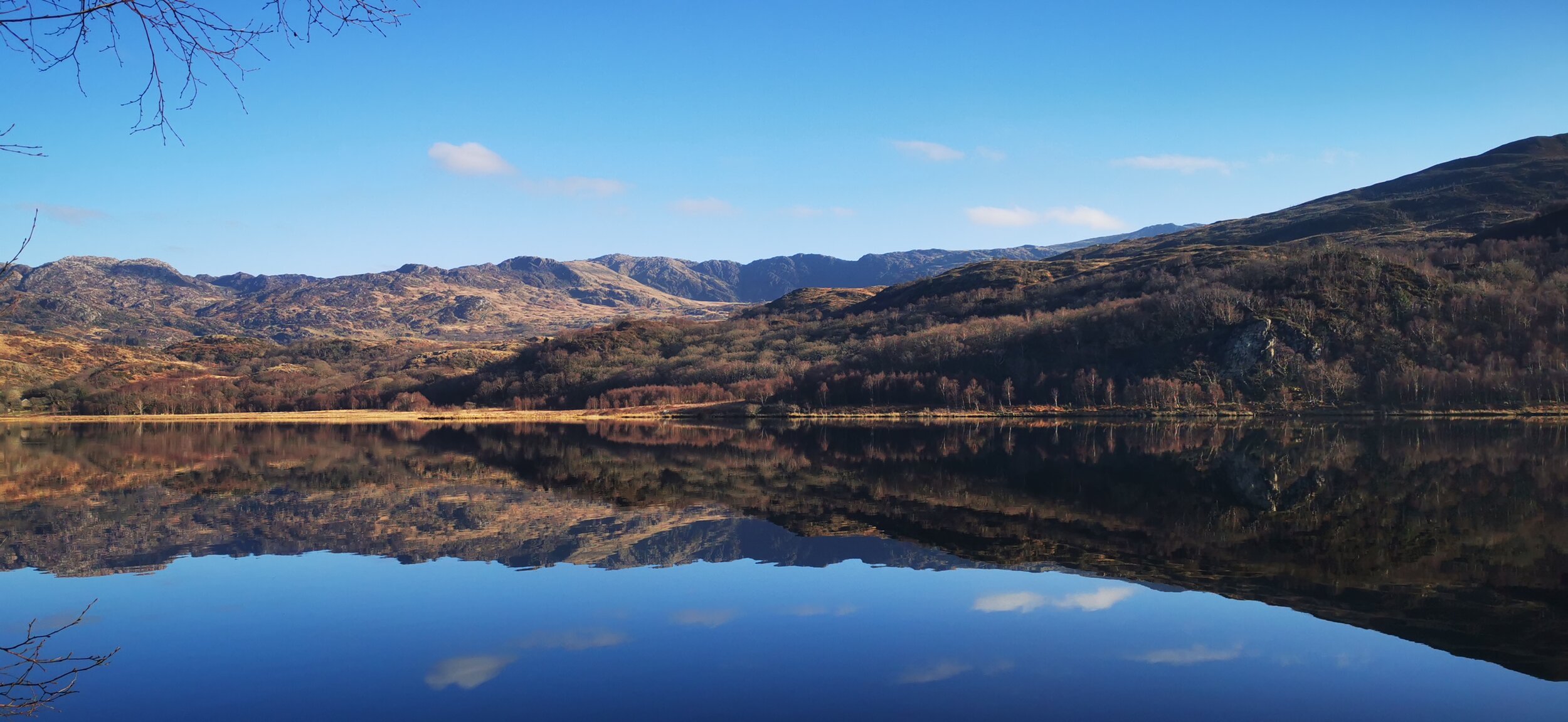
Llyn Dinas
Lakes, Waterfalls & Gorges
Being one of the wettest regions in the UK, Snowdonia has more than its fair share of waterfalls, lakes, rivers and gorges.
Popular waterfall walks include Rhaeadr Fawr (Aber Falls) from Abergwyngregyn in the far north of the National Park; Conwy Falls near Betws Y Coed; the Watkins Pools near Nantgwynant; Rhaeadr Du near Ganllwyd, and Nantcol near Llanbedr.
My favourite riverside and gorge trails are the beautiful Aberglaslyn Pass near Beddgelert, Ffos Anoddun near Betws y Coed, and the Gorges of Afon Mawddach and Afon Gain in Coed y Brenin near Dolgellau.
Some good lowland lakeside walks include around the very atmospheric Llyn Dinas near Beddgelert, Llyn Tegid (don’t expect peace and solitude here though), and a small section of trail at Llyn Cwellyn. Although not strictly speaking in the National Park, Llyn Padarn at Llanberis has a beautiful trail.
Trails
There are hundreds if not thousands of miles worth of established trails within the Snowdonia National Park, so really you’re spoilt for choice. If you like the idea of following an established route, below are some of the more well-known trails within, or passing through Snowdonia.

Snowdonia Slate Trail Marker
Snowdonia Way
The main long distance route offering a traverse of the National Park from Machynlleth to Conwy, there is a low-level and a mountain option here - the low level option is 97 miles, and the mountain route is 122 miles, and takes around 8 - 9 days to complete.
Snowdonia Slate Trail
An 83 mile immersion into the slate quarrying heritage of the Snowdonia National Park, this route takes around 7 days in its entirety and will take you through spectacular scenery, historical villages and interesting slate heritage sites.
Cambrian Way
The Cambrian Way is a spectacular route which crosses Wales from North to South, and a large portion of it crosses the Snowdonia National Park.
Wales Coast Path
The Snowdonia section of the Wales Coast Path runs from the Dyfi Estuary in the south of the park, to the Dwryd Estuary in the north.
Accesible Trails
The Mawddach Trail is probably the best accessible trail in Snowdonia, with stunning views and good facilities. Other options include Llyn Tegid, and a short trail at Llyn Cwellyn which is very peaceful.
Places to Stay & Eat
The Snowdonia National Park has some lovely small towns and villages that make great bases and offer facilities including food and outdoor shops, cafes, restaurants, accommodation, museums and more.
Beddgelert
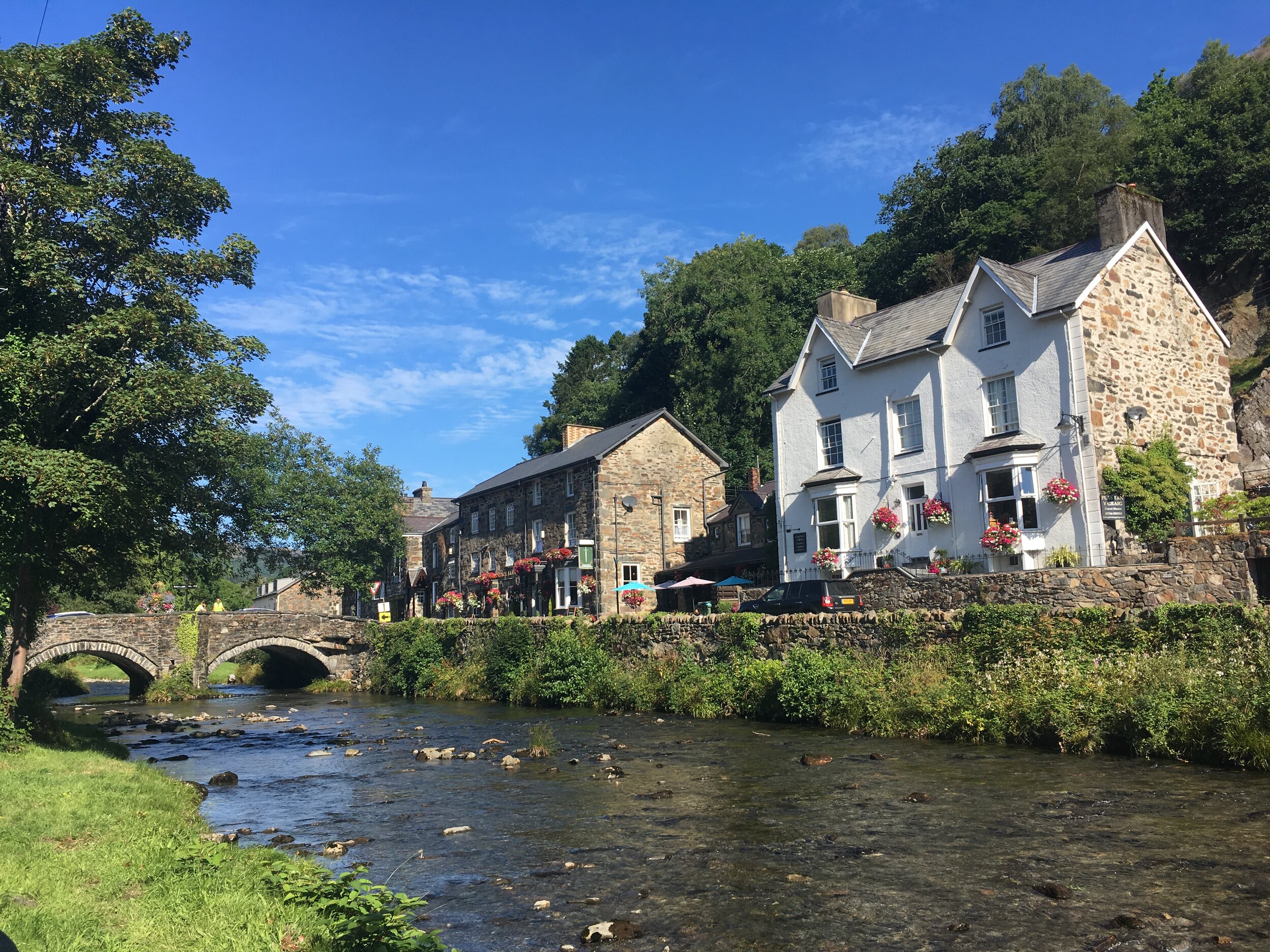
Betws y Coed
Betws y Coed, meaning little chapel in the woods, is a very picturesque village set amongst the Gwydyr Forest, at the meeting of the Afon Llugwy, Afon Machno and Afon Lledr with Afon Conwy. There are lots of accommodation options here, plenty of places to eat (my favourite is the Rainforest Cafe and Pizza place), outdoor equipment and clothing shops in case you’ve forgotten anything, public toilets, parking, fuel and cash, as well as a small train station and bus options. It does get very busy in peak times so it’s always good to plan ahead.
Capel Curig
Capel Curig is a small village that is perfectly situated for access to the Carneddau, Glyderau and Moel Siabod mountains. There are a few accommodation options here, plus one or two places to eat, and supported by a bus route, but you’d have to go ten minutes down the road to Betws Y Coed for more facilities. The National Mountain Centre Plas y Brenin is based here.
Dolgellau
In the south of the national park, Dolgellau is a beautiful historic market town with plenty of accommodation, food and facilities. This is a good option for Cader Idris and the Mawddach estuary.
Beddgelert
A small and touristy village, Beddgelert has several accommodation and food options, parking, public toilets and tourist information, and is popular due to its famous legend of the hound Gelert, but there is a lot more on offer - great access to walks including Snowdon, Moelwynion and the Hebog range as well as the Aberglaslyn Pass and Beddgelert Forest. There is a bus service and also the steam train which connects it to Caernarfon and Porthmadog.
Llanberis
Not officially part of the National Park, Llanberis is nonetheless one of the main access points for the mountains and has a lovely atmosphere, as well as a beautiful location next to Llyn Padarn and at the foot of the dramatic Llanberis pass. All the facilities you’d need, access to Snowdon and the Glyderau, plus some fun tourist activities for poor weather days. The National Slate Museum and Dolbadarn Castle are highlights.
Bethesda
A town built on slate quarrying, Bethesda has become an increasingly popular gateway into the mountains, set at the foot of Dyffryn Ogwen, and so giving access to the Carneddau and Glyderau mountains. All facilities are available here, parking isn’t the easiest though.
Blaenau Ffestiniog
Another slate quarrying town, the whole place seems to have grown from the surrounding mountains. It is a special place if you can appreciate the atmospheric qualities of its slate quarrying heritage. It isn’t situated in the National Park, but has become increasingly popular thanks to the range of adventure activities on offer here. Well located for the Moelwynion range, there is a steam train and bus service link here.
Harlech
Spectacularly situated on a hill above the coast, Harlech is known for its famous medieval castle. There are good food and accommodation options here, and a couple of small shops. Great for the coast path and the Rhinogydd.
Aberdyfi
A very popular but pretty coastal village, Aberdyfi offers lots of accommodation and food options. It gets extremely busy in the summer, so planning your visit ahead is a good plan. This is good for the coast path and Cader Idris.
Responsible Travel
Snowdonia is a designated National Park for a reason - it is important due to the nature, scenery, beauty, culture and history of the area, and when we’re visiting the park we have a responsibility to keep it that way for those who come after us.

Cwm Idwal Nature Reserve - A Site of Special Scientific Interest
Spread out
Consider visiting some of the less busy areas in the park to avoid adding to pressure in these areas. and if you can, visit outside of peak times.
Park Responsibly
There have been some shocking examples of bad parking en masse over the last couple of years, with gates being blocked, verges being ruined, and roads being blocked to emergency vehicles and buses by bad parking. Don’t do it! Car parks in the mountain areas fill up quickly, so arrive early, plan alternative routes and parking options for if your first choice is full, or better, plan your walks around the park and ride or even more fun, the steam train services!
Don’t light fires
In spring and summer especially this delicate area is very vulnerable to forest and grass fires, even with the best intentions fires can accidentally get out of hand so better to be safe than sorry.
Take your litter home & go to the toilet responsibly
Public toilets are available in most of the towns mentioned above. If you get caught out in the more remote areas, make sure you go away from trails, buildings or waterways, take any tissue out with you, and dig a deep hole for anything substantial and make sure it is buried afterwards!
Support local businesses
You’ll be hard pressed to find any massive chains or big brands in the national park anyway, but do consider using independent shops, visiting farmers markets, staying in official campsites and eating locally produced food - you’ll get an enriched experience of the national park if you do anyway!