Eryri (Snowdonia) Day Walk - Elidir Fawr, Mynydd Perfedd and Carnedd y Filiast

The path to Elidir Fawr
Explore three peaks of the western Glyderau range on this circular walk taking in Elidir Fawr, Mynydd Perfedd and Carnedd y Filiast. This route joins with the Snowdonia Slate Trail at the start / end, which you can follow for a few miles into Llanberis or Bethesda, making it public transport accessible.
Need to Know
Best time to walk: Possible all year round. In winter conditions this is for experienced winter mountaineers only. These hills often escapes the cloud that plagues the higher Glyderau, but be prepared in any case.
Map: OS Explorer, OL 17 Snowdon / Yr Wyddfa
Start: End of lane above Deiniolen, SH 5967 6310.
End: As start
Distance / Time: 9.5 km / 6 miles
Ascent: 700 m
Transport / Parking: Free parking for a small number of cars on the side of the lane (don’t block any gateways). Buses to Llanberis or Bethesda then follow the Snowdonia Slate Trail to start. (adds on about 3-4 miles)
Food / Drink / Supplies: None on route
The Route
View route map (you will need an OS Maps online account to access it.)

Looking over to the start of the route, you can see the lane below the dam centre left and a faint path cutting uphill
Follow the tarmacked lane uphill past the quarry and the Machlwyn Bach reservoir on the right. Continue on the lane as it climbs and curves right then left below the main quarry dam. When the lane forks, take the left fork then as it curves back around, look for a path on your right leading up onto the hillside.
Climb steeply heading north, to a saddle, then bear west until you approach the steep western face of the mountain. From here follow a faint path, sticking to the high ground, south west then west to the broad summit of Carnedd y Filiast, the first of the three peaks on this walk. There is a cairn here which can help as a navigation aid in poor weather.

Looking over to Elidir Fawr from Carnedd y Filiast, with Y Garn, Glyder Fawr and Glyder Fach stretching out centre to left ahead
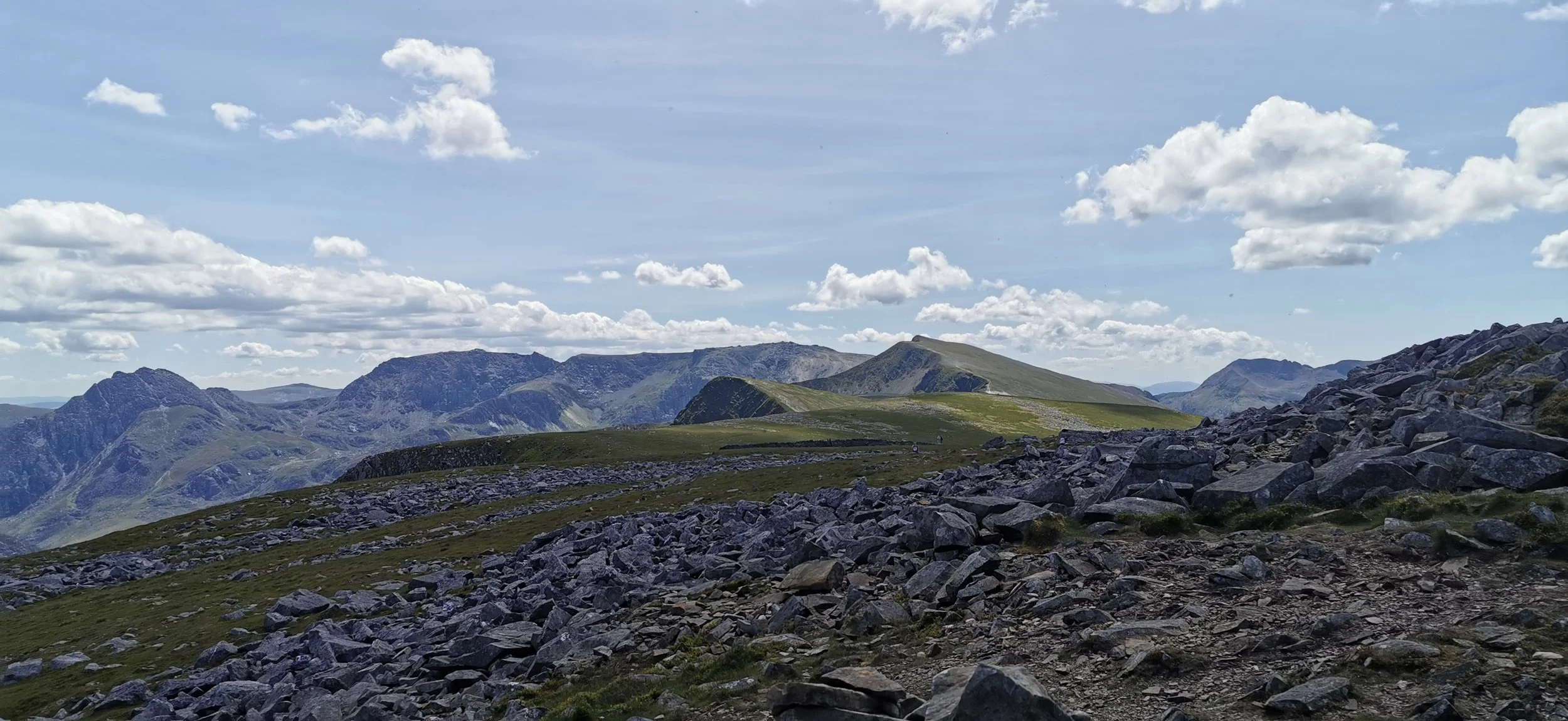
The rocky summit of Carnedd y Filiast, with the Glyderau range stretched out ahead
From the rocky summit, bear south west until you reach a large stone wall. From here the terrain is wide and open, in low cloud you may need to use a bearing from the wall, south to Mynydd Perfedd, but sticking to the higher ground or hugging the steep ground to the east will also work, as there is barely any descent or ascent between the two. At Mynydd Perfedd there is another cairn / shelter, not marked on the OS map, and a fence. From here you’ll change direction to walk south-east, following the fenceline, descending to Bwlch y Marchlyn, as the ground increasingly narrows.
Crossing from Carnedd y Filiast to Mynydd Perfedd

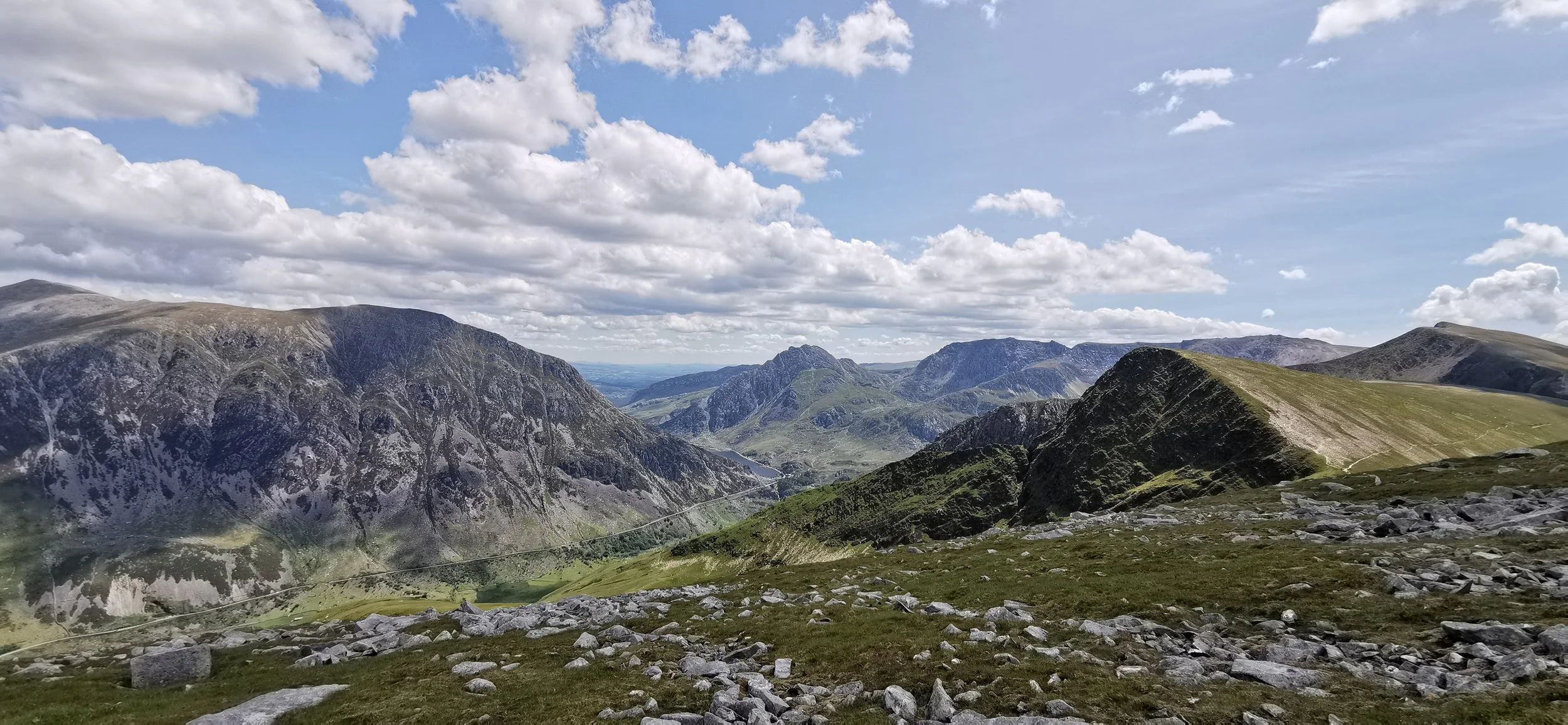
Views over Marchlyn Mawr to Elidir Fawr from Mynydd Perfedd
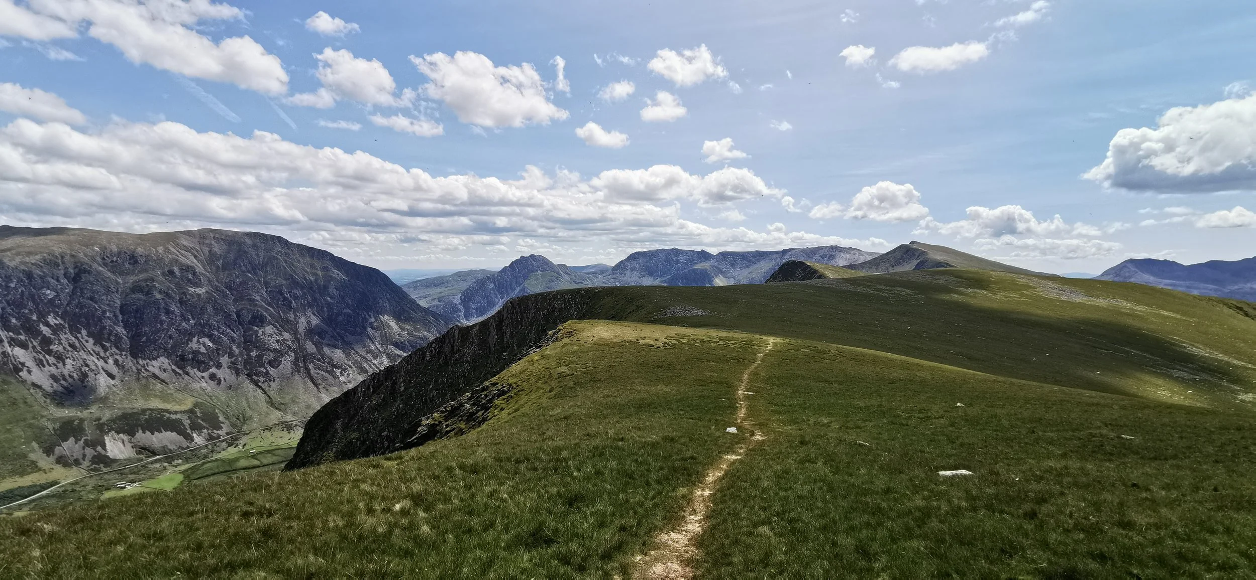
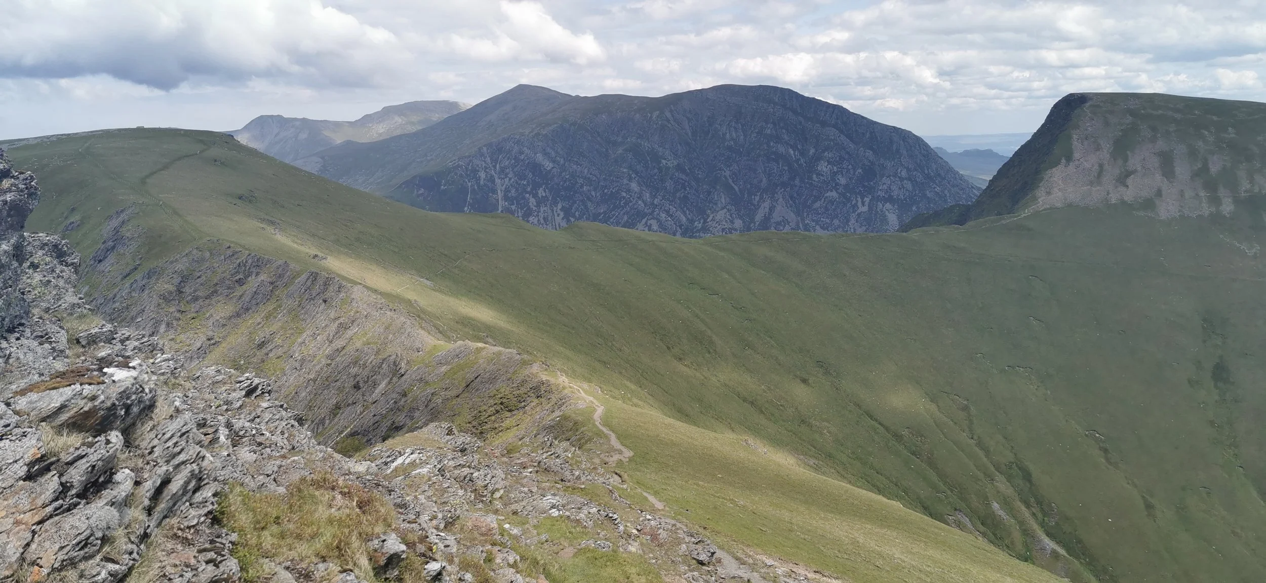
Exceptional views over the Ogwen Valley, Carneddau and Glyderau from Mynydd Perfedd
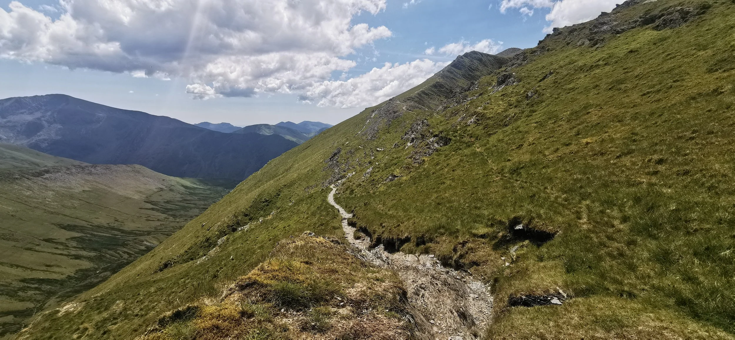
The narrow path between Mynydd Perfedd and Elidir Fawr, at Bwlch y Marchlyn

The climb up towards Elidir Fawr

The final push, getting closer to the summit
Looking back along the route from Mynydd Perfedd (left)

View from the summit of Elidir Fawr, back over the entirety of the route so far (L-R)

The view from Elidir Fawr looking west
Once you’ve reached the summit, continue along the high ground, west, ignoring a path that leads off to the south. There is some rock hopping and scree to be negotiated, but soon you’re down on the grassy slopes of Elidir Fach. The views here over the Llanberis pass and over to Crib Goch and Yr Wyddfa are breathtaking. Descend north to return to the lane at the Marchlyn Bach reservoir. Turn left on the lane to retrace your earlier steps back to the start.

Views over the Menai Strait and Deiniolen on the descent from Elidir Fach
Please note this route is for information and inspiration only and we can’t be held responsible for any inaccuracies or problems arising. As this is rough mountain terrain you should take a paper map and compass and be able to use them. Please be Adventure Smart.